place

McKnight District

Historic districts in Hampden County, MassachusettsHistoric districts on the National Register of Historic Places in MassachusettsNRHP infobox with nocatNational Register of Historic Places in Springfield, MassachusettsSpringfield, Massachusetts
Use mdy dates from August 2023
SpringfieldMA McKnightDistrict AmherstStreet

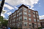
The McKnight District is a predominantly residential neighborhood northeast of downtown Springfield, Massachusetts. The area represents a planned residential development covering several hundred acres, which was built in the mid to late 19th century. The architects of the development were John and William McKnight, who, in addition to developing and enforcing construction guidelines in the area, built and landscaped many of the properties. The area was largely built by 1910, and there has been little new construction in the area since. Most of the houses built in the area were constructed in most of the architectural styles that were popular between 1880 and 1990, although there is a predominance of the Queen Anne style. The McKnights began to develop the area, which had previously been mainly farmland, in 1870 with the purchase of a 22 acres (8.9 ha) parcel on which they and a partner built their own homes. They proceeded over the following years to acquire additional parcels of land in the area, plat out roads, and either build houses themselves, or sell plots to other builders. They enforced some uniformity in the area through the use of deed restrictions, which required uniform setback requirements, banned fencing, and required a minimum cost of construction (the latter to prevent the building of inexpensive tenement-style housing).The neighborhood is roughly defined by the railroad tracks on the north and the Bay Street to the south. On the west it is roughly bounded by Armory and Magazine Streets, and on the east by Monmouth, Clifford, Bay, and Marion Streets. A portion of the neighborhood, encompassing some 130 acres (53 ha) and 350 homes, was designated a historic district and listed on the National Register of Historic Places in 1976. This was expanded in 1986 to 250 acres (100 ha) and 884 properties, encompassing virtually the entirety of the McKnight's development.

Excerpt from the Wikipedia article McKnight District (License: CC BY-SA 3.0, Authors, Images).

McKnight District
Saint James Avenue, Springfield

Geographical coordinates (GPS) Address Nearby Places
placeShow on map

Wikipedia: McKnight DistrictContinue reading on Wikipedia

Geographical coordinates (GPS)

Latitude Longitude
N 42.114444444444 ° E -72.571944444444 °
placeShow on map

Address

Saint James Avenue 171
01104 Springfield
Massachusetts, United States
mapOpen on Google Maps

SpringfieldMA McKnightDistrict AmherstStreet
Share experience

Nearby Places

Upper Worthington Historic District

The Upper Worthington Historic District of Springfield, Massachusetts encompasses a collection of visually cohesive residential apartment blocks that represent one of the largest residential developments in the city dating to the first three decades of the 20th century. It is centered on a portion of Worthington Street, a major east-west road in the city, between Armory Street and Summit Street, and includes 33 buildings on those three streets as well as Federal and Taylor Streets, near their junctions with either Worthington or Federal. Most of the contributing buildings are four story brick buildings with Georgian detailing and stone trim. The district was first listed on the National Register of Historic Places in 1983, including 28 buildings; the district was expanded in 1992 to add the five buildings on Taylor Street.The district is located on the northern side of the plateau that also houses the Springfield Armory. In the mid-19th century this area was developed with summer estates, which eventually succumbed to development pressures for higher density housing late in the 19th century. The Upper Worthington area was originally the estate of Horace Kibbe, which the firm of Gagnier & Angers offered to buy in 1908. Gagnier & Angers was a partnership of two French Canadian immigrants, who were one of the city's major real estate development and construction firms in the early 20th century. When the estate was finally partitioned in 1912, they purchased the largest part of it, and proceeded to build out the area over the next twenty years. Most of the residential blocks in the district were built either by that firm, or by one established by Albert Gagnier and Larry Angers, sons of its principals. The development was the largest of its type in the city at the time, and preserves a distinctive streetscape from the period.

Winchester Square Historic District

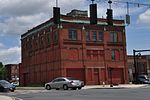
Winchester Square Historic District is a historic district encompassing a cluster of brick buildings at and near the intersection of State Street and Wilbraham Road on the east side of Springfield, Massachusetts. The buildings, most of which were built for industrial purposes, are clustered on five parcels, and were built between 1875 and 1913. It includes the Armory railroad station (1875), the Winchester Square fire station (1886, remodeled 1915), the Knox Automobile Company buildings (1891-1910), and the Indian Motorcycle Company plant, part of which later became the Springfield Industrial Institute complex. The district was listed on the National Register of Historic Places in 1979.The district became a target for industrial development after the construction of the Springfield and New London Railroad in 1870, which included a stop nearby. The oldest building in the district is that of the Bullard Repeating Arms Company, built in 1883 for a company that manufactured rifles. Its founder Jean Bullard, a prolific inventor, also built an early steam-powered automobile in 1887. One building was eventually taken over in 1895 by the Springfield Industrial Institute, which trained generations of workmen for Springfield's industries. The fire station was built to meet the demand for improved fire department response time in the developing area. The Hendee Manufacturing Company, later Indian, began operations in this district upon its organization in 1901; in 1914 it was the world's largest maker of motorcycles. It operated here until 1948, and closed its last plant in 1953.