place

Westover–Bacon–Potts Farm

Egremont, MassachusettsFarms on the National Register of Historic Places in MassachusettsHistoric districts on the National Register of Historic Places in MassachusettsNRHP infobox with nocatNational Register of Historic Places in Berkshire County, Massachusetts
Saltbox architecture in MassachusettsUse mdy dates from August 2023
62 Undermountain Rd (MA Route 41) , Egremont Mass

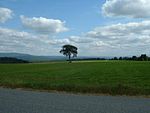
The Westover–Bacon–Potts Farm is a historic farm along Massachusetts Route 41 in Egremont, Massachusetts. Built beginning in 1744 on 150 acres (61 ha) of land, it is one of the best-preserved farmsteads of the period in Berkshire County. It was listed on the National Register of Historic Places in 1990. Until 2019, the property was owned by the Appalachian Trail Conservancy and was named the Kellogg Conservation Center. In 2019, Greenagers acquired the property "for a nominal sum" and renamed it the April Hill Conservation & Education Center.

Excerpt from the Wikipedia article Westover–Bacon–Potts Farm (License: CC BY-SA 3.0, Authors, Images).

Westover–Bacon–Potts Farm
Under Mountain Road,

Geographical coordinates (GPS) Address Nearby Places
placeShow on map

Wikipedia: Westover–Bacon–Potts FarmContinue reading on Wikipedia

Geographical coordinates (GPS)

Latitude Longitude
N 42.148055555556 ° E -73.416944444444 °
placeShow on map

Address

Under Mountain Road 62
01258
Massachusetts, United States
mapOpen on Google Maps

62 Undermountain Rd (MA Route 41) , Egremont Mass
Share experience

Nearby Places

Taconic and West Avenues Historic District

The Taconic and West Avenues Historic District is a largely residential historic district south of the downtown area of Great Barrington, Massachusetts. The roughly 117-acre (47 ha) district includes 172 contributing elements, most of which are houses or related buildings. Two thirds of the buildings were built between 1890 and 1910, and most of the rest were constructed in a historically sympathetic way.The southwestern corner of the district is the intersection of Maple and West Avenues. Its western boundary is a high wooded ridge that roughly parallels Castle Street, and follows Main Street and Maple Avenue on its eastern and southern boundaries. The housing in the district was built by Great Barrington's wealthier residents, and feature large houses built in a variety of popular styles of the period. The district features Georgian, Early Republic, and Mid 19th-Century Revival architecture. It was added to the National Register of Historic Places in 1998.Great Barrington was settled in the 18th century, and was the first county seat of Berkshire County. It developed around a major crossing of the Housatonic River, which also provided power for industry. Early development in this district occurred primarily along Main Street, where houses such as the Dwight–Henderson House were built, and Taconic Street, a major road leading northwest toward Alford. Development in the district was modest through much of the 19th century, only becoming more organized in the 1880s, when a number of cross streets were laid out for residential development.