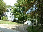
Mount Everett
Mountains of Berkshire County, MassachusettsTaconic MountainsUse mdy dates from August 2022

Mount Everett is the highest peak in the south Taconic Mountains, rising about 2,000 feet above its eastern footings in Sheffield, Mass. Its summit area is notable for expansive vistas and an unusual dwarf forest of pitch pine and oak. The Appalachian Trail traverses Mount Everett, which prior to the 20th century was called "Dome of the Taconics." Reaching 2,602 feet (793 meters) above sea level, Everett dominates much local scenery of the Housatonic Valley.
Excerpt from the Wikipedia article Mount Everett (License: CC BY-SA 3.0, Authors, Images).Mount Everett
AT Connector Trail,
Geographical coordinates (GPS) Address Nearby Places Show on map
Geographical coordinates (GPS)
| Latitude | Longitude |
|---|---|
| N 42.101944444444 ° | E -73.4325 ° |
Address
Mount Everett Lookout Tower
AT Connector Trail
01258
Massachusetts, United States
Open on Google Maps


