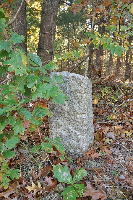
Town Boundary Markers of Barnstable, Massachusetts
1639 establishments in Plymouth ColonyBarnstable, MassachusettsBuildings and structures completed in 1639Geographic coordinate listsGeography of Barnstable County, Massachusetts ... and 8 more
Historic district contributing properties in MassachusettsInitial pointsLists of coordinatesNRHP infobox with nocatNational Register of Historic Places in Barnstable, MassachusettsSandwich, MassachusettsUse mdy dates from August 2023Yarmouth, Massachusetts

The town of Barnstable, Massachusetts has four surviving stone markers that were used in colonial days to mark the town's boundaries with its neighbors. All four are listed on the National Register of Historic Places, three of them individually, and one as part of the Old King's Highway Historic District. Barnstable was established in 1639.
Excerpt from the Wikipedia article Town Boundary Markers of Barnstable, Massachusetts (License: CC BY-SA 3.0, Authors, Images).Town Boundary Markers of Barnstable, Massachusetts
Race Lane,
Geographical coordinates (GPS) Address Nearby Places Show on map
Geographical coordinates (GPS)
| Latitude | Longitude |
|---|---|
| N 41.686388888889 ° | E -70.436666666667 ° |
Address
Race Lane 1
02644
Massachusetts, United States
Open on Google Maps


