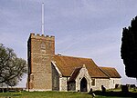
Honey Bottom
Berkshire geography stubsHamlets in BerkshireWest Berkshire District
Honey Bottom (also written as Honeybottom) is a hamlet in the civil parish of Shaw-cum-Donnington in the English county of Berkshire. The settlement lies approximately 2.5 miles (4.0 km) north-west of the town of Newbury, between the villages of Bagnor and Winterbourne. It covers the very north-eastern portion of the Donnington half of the parish of Shaw-cum-Donnington, on the southern edge of Snelsmore Common.
Excerpt from the Wikipedia article Honey Bottom (License: CC BY-SA 3.0, Authors).Honey Bottom
Grove Road,
Geographical coordinates (GPS) Address Phone number Website Nearby Places Show on map
Geographical coordinates (GPS)
| Latitude | Longitude |
|---|---|
| N 51.430729 ° | E -1.347461 ° |
Address
Donnington Grove Country Club
Grove Road
RG14 2LA , Speen
England, United Kingdom
Open on Google Maps


