place

Grindslow Knoll

Derbyshire geography stubsMountains and hills of DerbyshireMountains and hills of the Peak District
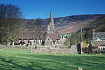
Head of Grindsbrook Clough, Edale geograph.org.uk 256992

Grindslow Knoll is a hill in the Dark Peak area of the Peak District National Park in Derbyshire, England. It is joined to Kinder Scout by a high col though from most angles appears as an independent peak. It is the high point at the western side of Grindsbrook Clough.

Excerpt from the Wikipedia article Grindslow Knoll (License: CC BY-SA 3.0, Authors, Images).

Grindslow Knoll
High Peak Edale

Geographical coordinates (GPS) Address Nearby Places
placeShow on map

Wikipedia: Grindslow KnollContinue reading on Wikipedia

Geographical coordinates (GPS)

Latitude Longitude
N 53.378333333333 ° E -1.8366666666667 °
placeShow on map

Address

Fox Holes


S33 7ZJ High Peak, Edale
England, United Kingdom
mapOpen on Google Maps

Head of Grindsbrook Clough, Edale geograph.org.uk 256992
Share experience

Nearby Places

Vale of Edale
Vale of Edale

The Vale of Edale is the upper valley of the River Noe, in the Derbyshire Peak District of England. The village of Edale lies in the middle of the valley.Edale Head, on the Kinder Scout plateau, is the source of the River Noe (a tributary to the River Derwent). The River Noe flows out of the foot of the Vale of Edale into Hope Valley, past the village of Hope and through Brough-on-Noe, where the Romans established Navio fort. On the north side of the valley is the Kinder moorland plateau. On the south side is the ridge of Rushup Edge and Great Ridge, over Mam Tor and Hollins Cross to Lose Hill. The other settlements in the valley are the hamlets of Upper Booth, Barber Booth and Nether Booth. The Hope Valley railway line (Manchester to Sheffield) runs along the Vale of Edale. The train line, built by Midland Railway, and Edale railway station were opened in 1894. At the western end of the Vale of Edale the line heads through the 3.4 kilometres (2.1 mi) long Cowburn Tunnel at Dale Head, under the moorland hill of Brown Knoll.Edale is the start of the Pennine Way long distance footpath, which runs from Derbyshire to Scotland. The trail heads west through Upper Booth and up Jacob's Ladder footpath to the Kinder plateau. At the foot of Jacob's ladder is a gritstone packhorse bridge, with a single span which crosses the River Noe. It is a designated Grade II structure. The bridge is on an important medieval packhorse route over the Pennine moorland between Hayfield and Edale. Salt and cheese from Cheshire and cotton from the Lancashire mills were transported to the east, while coal and lead were carried to the west. Doctor's Gate Roman road ran along the hillside at the eastern end of the valley.The land along the banks of the River Noe between Barber Booth and Jacob's Ladder is protected as Edale SSSI (Site of Special Scientific Interest). The banks and riverbed contain important fossils from the rocks known as Edale Shales. There are kestrels, buzzards and curlews in the valley. The trees along the hillsides include birch, rowan and alder. Jacob's ladder footpath runs across land that is owned and managed by the National Trust. It is also part of the Kinder Scout SSSI, which was designated as a National Nature Reserve in 2009.

Jacob's Ladder, Derbyshire

Jacob's Ladder is a bridleway between Kinder Scout plateau and the hamlet of Upper Booth in the Vale of Edale, in the Derbyshire Peak District of England. In the 18th century Jacob Marshall farmed the land at Edale Head, at the top of what became known as Jacob's Ladder. He cut steps into this steep section of the route up to the Kinder plateau. The name is a reference to the ladder to heaven that Jacob dreamt about (in the Book of Genesis).Edale Head is the source of the River Noe (a tributary to the River Derwent), which flows down the clough (steep valley) alongside the path. At the foot of Jacob's Ladder is a gritstone packhorse bridge, with a single span which crosses the River Noe. It is a designated Grade II structure. The bridge is on an important medieval packhorse route over the Pennine moorland between Hayfield and Edale. Salt and cheese from Cheshire and cotton from the Lancashire mills were transported to the east, while coal and lead were carried to the west. Edale Cross is a medieval wayside cross at the top of Jacob's Ladder. It marks the boundary between the three wards of Forest of High Peak: Glossop and Longdendale, and Hopedale and Campagna. The cross is a protected Scheduled Monument. The mass trespass of Kinder Scout, carried out by about 500 walkers in 1932, passed the top of Jacob's Ladder on the way from Kinder Downfall back to Hayfield, where they began the walk.The Pennine Way long-distance footpath, from Derbyshire to Scotland, ascends Jacob's Ladder, just 2.5 miles (4.0 km) from its start at Edale. The original route of the Pennine Way went up to the Kinder plateau via Grindsbrook Clough. In 1987 the Manpower Services Commission built a stone paved staircase along the path of Jacob's Ladder.Jacob's Ladder footpath runs across land that is owned and managed by the National Trust. It is also part of the Kinder Scout protected Site of Special Scientific Interest (SSSI), which was designated as a National Nature Reserve in 2009. There are kestrels, buzzards and curlews in the valley. The trees along the hillsides include birch, rowan and alder.Access to the foot of Jacob's Ladder can be made along the Pennine Way trail from Edale railway station or from the public car park at Barber Booth.