Cèze
France river stubsOccitania (administrative region) geography stubsPages with French IPARivers of FranceRivers of Gard ... and 3 more
Rivers of LozèreRivers of Occitania (administrative region)Tributaries of the Rhône

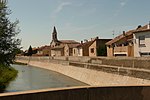
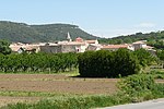
The Cèze (French pronunciation: [sɛz]; Occitan: Céser) is a karstic French river, a right tributary of the Rhône. It runs through the departments of Lozère and Gard in the Occitanie region. It is 128 km (80 mi) long, and its basin area is 1,360 km2 (530 sq mi). Its source is in the Cévennes mountains, near Saint-André-Capcèze. It flows through Bessèges, Saint-Ambroix, Bagnols-sur-Cèze, and it flows into the Rhône at Codolet, southwest of Orange. Its longest tributaries are the Luech, Auzon, Tave, Ganière and Aiguillon.In the dry season, the Cèze sometimes dries up.
Excerpt from the Wikipedia article Cèze (License: CC BY-SA 3.0, Authors, Images).Cèze
Laudun-l'Ardoise
Geographical coordinates (GPS) Address Nearby Places Show on map
Geographical coordinates (GPS)
| Latitude | Longitude |
|---|---|
| N 44.108333333333 ° | E 4.7036111111111 ° |
Address
30290 Laudun-l'Ardoise
Occitania, France
Open on Google Maps


