Aigues
Drôme geography stubsFrance river stubsHautes-Alpes geography stubsPages with French IPARivers of Auvergne-Rhône-Alpes ... and 7 more
Rivers of DrômeRivers of FranceRivers of Hautes-AlpesRivers of Provence-Alpes-Côte d'AzurRivers of VaucluseTributaries of the RhôneVaucluse geography stubs

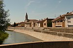
The Aigues (French pronunciation: [ɛɡ]), Aigue, Aygues or Eygues is a French river, a tributary of the Rhône. It runs through the departments of Drôme, Hautes-Alpes and Vaucluse. Its source is in the Baronnies mountains. It flows through Verclause, Sahune, Nyons, and it flows into the Rhône at Caderousse. It is 113.7 km (70.6 mi) long. Its drainage basin is 1,012 km2 (391 sq mi).Several spellings of the name are in use: the French national map service Géoportail shows both "l'Aigues" and "l'Aygues" on maps of the same area near Orange, and the village name of Saint-Maurice-sur-Eygues preserves another variant. Among its tributaries is the Lauzon.
Excerpt from the Wikipedia article Aigues (License: CC BY-SA 3.0, Authors, Images).Aigues
Chemin du Chambonnet, Nîmes
Geographical coordinates (GPS) Address Nearby Places Show on map
Geographical coordinates (GPS)
| Latitude | Longitude |
|---|---|
| N 44.0884 ° | E 4.7369 ° |
Address
Chemin du Chambonnet
30150 Nîmes
Occitania, France
Open on Google Maps


