place

Philips Park, Prestwich

Irwell ValleyLocal Nature Reserves in Greater ManchesterParks and commons in the Metropolitan Borough of BuryPrestwichUrban public parks in the United Kingdom
Vague or ambiguous time from February 2021Whitefield, Greater Manchester

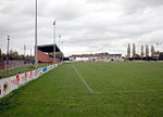
Philips Park is an area of parkland situated within the Metropolitan Borough of Bury on the boundary of Whitefield and Prestwich, in Greater Manchester. The park consists of rich woodland and grassland habitat and is home to an assortment of wildlife. Two thirds of the site was once the Philips family estate, and the remainder, known as Waterdale, is Irwell Valley land reclaimed following the demolition of two bleach and dye works. The park is a local nature reserve.The park is also home to the Barn Countryside Centre. The visitor centre hosts many events for all ages, including willow weaving and pottery workshops, pond dipping and woodland management training courses.

Excerpt from the Wikipedia article Philips Park, Prestwich (License: CC BY-SA 3.0, Authors).

Philips Park, Prestwich
Red Route,

Geographical coordinates (GPS) Address Nearby Places
placeShow on map

Wikipedia: Philips Park, PrestwichContinue reading on Wikipedia

Geographical coordinates (GPS)

Latitude Longitude
N 53.53263 ° E -2.307537 °
placeShow on map

Address

Red Route
M45 7QJ , Park Lane
England, United Kingdom
mapOpen on Google Maps

Share experience

Nearby Places

Stand, Greater Manchester

Stand is a residential area in Whitefield, Greater Manchester, England. The name is derived from a hunting stand, from which the surrounding countryside could be scanned for game.Stand Old Hall, built on the highest point in Whitefield overlooking Pilkington Deer Park (now the junction of Stand Lane and Ringley Road) was the manor house of the Pilkington family, Lords of the Manor of Pilkington and Bury. Stand Old Hall was replaced by Stand Hall around 1515 after the Earl of Derby took control of Pilkington. The old hall was converted into a barn and in the 19th century it became a shippon (cowshed). The old hall fell into disrepair and was demolished in the early 1960s. The view from Stand Hall was described in 1806.All Saints' Church on Church Lane is a Grade I Listed Anglican parish church designed by Charles Barry and built between 1821 and 1826.Stand Grammar School was founded in 1688 under the will of Henry Siddall and had close connections with the Unitarian Chapel in Ringley Road. The school ran into financial difficulties in the early 20th century and was taken over by Lancashire Education Committee in 1908. A new school was built on Church Lane on seven acres of land bought from the Earl of Derby and opened on 6 September 1913. The school catered for both boys and girls until 1937 when a separate girls' school was opened on Higher Lane. The boys' school continued to develop with 700 pupils on roll and eventually became part of Bury College and was demolished in 2001. Some believe Robert Clive had links with the school in his early years. Accounts suggest that the Old Standians’ Association began attempts to link Clive to the school some time around 1907. Sir Colvin Bayley (the grandson of Clive’s uncle) stated at a school event that he had been informed Clive had attended the school, prior to living in Hope Hall in Eccles. However, this link has been queried, as even as Bayley admitted, there is no mention of it in any records. Despite this, the Old Standians' Association erected a bronze plaque and named one of the school's houses in his honour in 1913.Some of the alternative rock band Elbow met whilst studying at Stand College in the 1990s. Stand Grammar School for Girls on Higher lane was later renamed Philips High School and is now a comprehensive school and specialist maths and computing college.