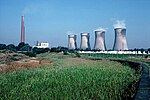
Drinkwater Park
Irwell ValleyParks and commons in the Metropolitan Borough of BuryPrestwich

Drinkwater Park is situated in the Irwell Valley on the western border of Prestwich, near Manchester, bounded by the River Irwell to the west, Agecroft Road and Rainsough Brow (A6044) to the south, Butterstile Lane and Carr Clough estate to the east and Bunkers Hill to the north. The park is administered by Forestry England and is part of Prestwich Forest Park, which also incorporates Philips Park, Mere Clough, Prestwich Clough, Forest Bank Park in Pendlebury and Waterdale Meadow.
Excerpt from the Wikipedia article Drinkwater Park (License: CC BY-SA 3.0, Authors, Images).Drinkwater Park
Grundy Avenue,
Geographical coordinates (GPS) Address Nearby Places Show on map
Geographical coordinates (GPS)
| Latitude | Longitude |
|---|---|
| N 53.521111111111 ° | E -2.2988888888889 ° |
Address
Grundy Avenue
M25 9TG
England, United Kingdom
Open on Google Maps


