place

Double Eagle II Airport

1980s establishments in New MexicoAirports in New MexicoBuildings and structures in Albuquerque, New MexicoTransportation in Albuquerque, New MexicoUse mdy dates from November 2014
Double Eagle II Airport

Double Eagle II Airport (ICAO: KAEG, FAA LID: AEG) is a public airport located seven miles (11 km) northwest of the central business district of Albuquerque, a city in Bernalillo County, New Mexico, United States. It is owned by the City of Albuquerque.Located on the far west side of the city, it is Albuquerque's second airport after Albuquerque International Sunport. Construction began in 1982, and the airport was named for the Double Eagle II balloon, the first balloon to cross the Atlantic Ocean, piloted by Ben Abruzzo, Maxie Anderson, and Larry Newman. Although most U.S. airports use the same three-letter location identifier for the FAA and IATA, Double Eagle II is assigned AEG by the FAA but has no designation from the IATA (which assigned AEG to Aek Godang Airport in Padang Sidempuan, Sumatra, Indonesia).General aviation, air ambulance, corporate flights, military flights, training flights, charter, and private make up approximately 80,000 annual operations. Utilicraft Aerospace Industries announced in 2005 that it had secured a major investment from the Navajo Nation to build Utilicraft FF-1080 cargo aircraft at Double Eagle II. The deal later fell apart and no planes were built, though the company continued to seek other funding.

Excerpt from the Wikipedia article Double Eagle II Airport (License: CC BY-SA 3.0, Authors, Images).

Double Eagle II Airport
Double Eagle Airport Road Northwest, Albuquerque

Geographical coordinates (GPS) Address Nearby Places
placeShow on map

Wikipedia: Double Eagle II AirportContinue reading on Wikipedia

Geographical coordinates (GPS)

Latitude Longitude
N 35.145277777778 ° E -106.79527777778 °
placeShow on map

Address

C@04/22

Double Eagle Airport Road Northwest
Albuquerque
New Mexico, United States
mapOpen on Google Maps

Double Eagle II Airport
Share experience

Nearby Places

JA volcano
JA volcano

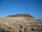
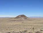
JA Volcano is an inactive volcano located near Albuquerque, New Mexico. JA Volcano is the southernmost of 5 volcanoes in a 5-mile chain within the western boundary of Petroglyph National Monument.The volcano has been the site of repeated pranks: "Volcano “Erupts” But Fools No One—a 1950 newspaper headline declared. Nobody was fooled, apparently, because the same prank—piling tires on the side of a volcano and setting them on fire to simulate an eruption—had been tried in 1947 with much greater success (even causing a panic in the city). For years students from nearby St Joseph would paint a "J" on Vulcan Volcano, when the light is right it can still be seen." St. Joseph College was later named the University of Albuquerque. In 1950 the College of St. Joseph began its move into a newly built campus on the palisades along the Rio Grande below the volcano. The name was changed to the College of St. Joseph on the Rio Grande. In 1966, the institution changed its name again to the University of Albuquerque. Twenty years later, it closed its doors and became the campus of Pius X high school. The volcano is composed of a type of volcanic rock called olivine tholeiitic basalt. Radiometric dating indicates an age for this rock of about 156,000 years. The volcano consists of two flows with a spatter cone at the center. Late in the eruption, subterranean pressure bulged the surface beneath the cone, causing radial cracking that resulted in emplacement of dikes around the cone. A final explosion blew out the eastern rim of the cone.

Petroglyph National Monument

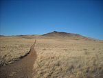
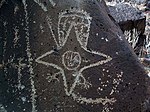
Petroglyph National Monument stretches 17 miles (27 km) along Albuquerque, New Mexico's West Mesa, a volcanic basalt escarpment that dominates the city's western horizon. Authorized June 27, 1990, the 7,236 acres (2,928 ha) monument is cooperatively managed by the National Park Service and the City of Albuquerque. The western boundary of the monument features a chain of dormant fissure volcanoes. Beginning in the northwest corner, Butte volcano is followed to its south by Bond, Vulcan, Black and JA volcanoes. Petroglyph National Monument protects a variety of cultural and natural resources including five volcanic cones, hundreds of archeological sites and an estimated 24,000 petroglyph images carved by Ancestral Pueblo peoples and early Spanish settlers. Many of the images are recognizable as animals, people, brands and crosses; others are more complex. Their meaning was, possibly, understood only by the carver. These images are the cultural heritage of a people who have long since moved into other areas and moved on through history for many reasons. The monument is intended as a protection for these lands and sites from and for visitors to see and appreciate for generations to come. The national monument is managed in a manner that allows recreational use. The monument has four major sites that visitors can access, Boca Negra Canyon, Rinconada Canyon, Piedras Marcadas Canyon, and the Volcano Day Use trails.