place

Awsworth railway station

Beeching closures in EnglandBorough of BroxtoweDisused railway stations in NottinghamshireEast Midlands railway station stubsFormer Great Northern Railway stations
Pages with no open date in Infobox stationRailway stations in Great Britain closed in 1964Railway stations in Great Britain opened in 1880Use British English from July 2015
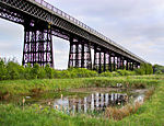
Awsworth railway station (site), Nottinghamshire (geograph 4801730)

Awsworth railway station was a former railway station in Awsworth, Nottinghamshire. It was opened by the Great Northern Railway on its Derbyshire and Staffordshire Extension in 1875–6.

Excerpt from the Wikipedia article Awsworth railway station (License: CC BY-SA 3.0, Authors, Images).

Awsworth railway station
Attewell Road, Broxtowe

Geographical coordinates (GPS) Address Nearby Places
placeShow on map

Wikipedia: Awsworth railway stationContinue reading on Wikipedia

Geographical coordinates (GPS)

Latitude Longitude
N 52.99299 ° E -1.28729 °
placeShow on map

Address

Attewell Road

Attewell Road
NG16 2SY Broxtowe
England, United Kingdom
mapOpen on Google Maps

Awsworth railway station (site), Nottinghamshire (geograph 4801730)
Share experience

Nearby Places

Bennerley Viaduct
Bennerley Viaduct

Bennerley Viaduct (originally Ilkeston Viaduct and known informally as the Iron Giant) is a former railway bridge, now a foot and cycle bridge, between Ilkeston, Derbyshire, and Awsworth, Nottinghamshire, in central England. It was completed in 1877 and carried the Great Northern Railway's (GNR) Derbyshire Extension over the River Erewash, which forms the county boundary, and its wide, flat valley. The engineer was Samuel Abbott, who worked under Richard Johnson, the GNR's chief engineer. The site required a bespoke design as the ground would not support a traditional masonry viaduct due to extensive coal mining. The viaduct consists of 16 spans of wrought iron, lattice truss girders, carried on 15 wrought iron piers which are not fixed to the ground but are supported by brick and ashlar bases. The viaduct is 60 feet (18 metres) high, 26 feet (8 metres) wide between the parapets, and over a quarter of a mile (400 metres) long. It was once part of a chain of bridges and embankments carrying the railway for around two miles (three kilometres) across the valley but most of its supporting structures were demolished when the line closed in 1968. The only similar surviving bridge in the United Kingdom is Meldon Viaduct in Devon. The viaduct opened in January 1878. Its working life was uneventful except for minor damage inflicted by a Zeppelin bombing raid during the First World War. Plans to demolish the viaduct failed because of the cost of dismantling the ironwork and it became a listed building in 1974. After closure, the viaduct received little maintenance and fell into disrepair. Railway Paths, a walking and cycling charity, acquired it for preservation in 2001 but work faltered due to a lack of funding. The viaduct was listed on the Heritage at Risk Register in 2007 and the 2020 World Monuments Watch for its condition and lack of use. A detailed survey was undertaken in 2016 and funding for restoration work was secured in 2019. The work included rebuilding an embankment to allow step-free access. It opened to the public as part of a cycling and walking route in January 2022.

Giltbrook

Giltbrook is a village in England situated approximately 6 miles (9.7 km) northwest of Nottingham and within close reach of junction 26 of the M1 motorway. It is part of Greasley (Giltbrook and Newthorpe) ward, which had a population of 6,076 in 2001, increasing to 6,233 at the 2011 Census.The name Giltbrook is believed to come from the old English name "Gylden Broc", which means golden stream, or brook. This relates to the brook that runs from the fields to the north of IKEA, and then continues under Nottingham Road at Giltbrook, and under the IKEA entrance, finally flowing into the River Erewash. Notable events include Giltbrook being the end point of the Pentrich rising where a small force of soldiers: twenty men of the 15th Regiment of Light Dragoons ended the rising. Some streets have been named after the ring leaders, with names such as Brandreth, Turner and Ludlam being used. The village is home to the Giltbrook Retail Park which has been developed due to the presence and popularity of IKEA, Decathlon and a Next store. In 2008 a whole retail park was built on the land next to IKEA, including Pets at Home, Laura Ashley, Comet, BHS, Boots, and Carpet Right. Comet, BHS and Laura Ashley have now ceased trading, being replaced by TK Maxx, Marks & Spencer and DFS respectively. Other local businesses include the head office of Essentra Packaging, one pub, the Hayloft, a cob shop, a fish and chip shop, a hairdressers, a Chinese takeaway, carpet shop, plumbing shop and a garage. Giltbrook was previously home to the New White Bull public house which dated back to the turn of the 19th century. After failed attempts to save the pub, it closed on 7 January 2015 to make way for the development of a Co-operative Food store.Giltbrook is represented on the Broxtowe Borough Council by three Conservative councillors, Nottinghamshire County Council by one independent councillor and the House of Commons by Conservative MP Darren Henry. One notable person who was born in Giltbrook was the undefeated bare knuckle fighter and boxer, Bartley Gorman, known as King of the Gypsies.

Ilkeston railway station

Ilkeston railway station serves the town of Ilkeston, Derbyshire, England. It is located at the site of the former Ilkeston Junction and Cossall station, on the Midland Main Line between Nottingham and Langley Mill. It is served by Northern Nottingham to Leeds services and by East Midlands Railway. During 2013, Derbyshire County Council presented its business case for the construction of a railway station for Ilkeston; at this point, it was considered to be the largest town to have an operational passenger line running through it but without any station serving it. Later that year, the project gained official backing and financing from the UK government via the New Stations Fund, which is managed by national railway infrastructure maintenance company Network Rail. Despite original plans to open the station during 2014, construction work was repeatedly delayed to account for numerous factors at the site selected, including the potential for flooding, ground instability from historic mining activity, and the presence of endangered species. During April 2016, work finally commenced at the site; the construction process, which involved several bespoke designs to accommodate site conditions, was completed within ten months. The new station was opened on 2 April 2017. It has two platforms, ticket vending machines, a wheelchair-accessible footbridge, a sizable car park and a taxi rank. Early passenger numbers have exceeded expectations.