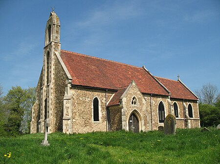
Hatley, Cambridgeshire
Civil parishes in CambridgeshireEngvarB from July 2016South Cambridgeshire District

Hatley is a civil parish in South Cambridgeshire, England. It lies between the villages of Gamlingay and Croydon, 12 miles south-west of the city of Cambridge and eight miles south-east of the town of St Neots. In 2001, the population of Hatley parish was 205 people living in 77 households, reducing at the 2011 Census to a population of 181 in 78 households.
Excerpt from the Wikipedia article Hatley, Cambridgeshire (License: CC BY-SA 3.0, Authors, Images).Hatley, Cambridgeshire
Main Street, South Cambridgeshire
Geographical coordinates (GPS) Address Nearby Places Show on map
Geographical coordinates (GPS)
| Latitude | Longitude |
|---|---|
| N 52.1427 ° | E -0.1288 ° |
Address
Main Street
Main Street
SG19 3SH South Cambridgeshire
England, United Kingdom
Open on Google Maps


