place

Newton County Courthouse (Indiana)

1906 establishments in IndianaBuildings and structures in Newton County, IndianaCounty courthouses in IndianaCourthouses on the National Register of Historic Places in IndianaGovernment buildings completed in 1906
National Register of Historic Places in Newton County, IndianaNorthern Indiana Registered Historic Place stubsRenaissance Revival architecture in Indiana
Newton County Courthouse in Kentland from southeast

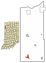
The Newton County Courthouse is a historic courthouse located at Kentland, Newton County, Indiana, United States. The original Newton County was formed by statute on February 7, 1835, and was a roughly square area some 30 miles on a side, encompassing what is now the northern half of the county, the northern half of Jasper County, and a large section to the north. The northern border was cut back to the Kankakee River on February 1, 1836, with all land north of the Kankakee River going to Lake and Porter counties. The county was abolished and combined with Jasper County in 1839. On December 8, 1859, the county was recreated and the borders were redrawn to essentially their current state.The current Newton County Courthouse was built in 1906, and is a three-story, rectangular, Renaissance Revival style brick building with limestone trim. It has an architectural tile hipped roof. The front facade features round arched windows on the third floor, projecting entrance pavilion, and a pedimented parapet.: 5 It was listed on the National Register of Historic Places in 2008.

Excerpt from the Wikipedia article Newton County Courthouse (Indiana) (License: CC BY-SA 3.0, Authors, Images).

Newton County Courthouse (Indiana)
East Graham Street,

Geographical coordinates (GPS) Address Nearby Places
placeShow on map

Wikipedia: Newton County Courthouse (Indiana)Continue reading on Wikipedia

Geographical coordinates (GPS)

Latitude Longitude
N 40.768888888889 ° E -87.445555555556 °
placeShow on map

Address

East Graham Street 215
47951
Indiana, United States
mapOpen on Google Maps

Newton County Courthouse in Kentland from southeast
Share experience

Nearby Places

Kentland crater
Kentland crater

The Kentland structure, also known as the Kentland crater or the Kentland disturbed area, is an impact structure located near the town of Kentland in Newton County, Indiana, United States.It was discovered about 1880 when two farmers began to quarry crushed rock there. The presence of shatter cones and deformed bedrock led geologists to conclude by the late 1960s that the Kentland structure is a deeply eroded impact structure, rather than volcanic in origin. Deformation at the site is so great that vertical contacts between normally horizontal rock formations of different ages are common. The structure itself is a circular dome, about 7.24 km (4.50 mi) in diameter, deeply eroded and buried in glacial debris. Its age is estimated to be less than 97 million years (Cretaceous or younger). The Shakopee dolomite at the center of the structure is about 450 million years old (Ordovician period) and is uplifted about 2,000 feet higher than the level of the same rock in the surrounding area. The entire disturbed area is about 13 km (8.1 mi) in diameter. The estimated age is in dispute. ‘"97 MYA‘" Late Cretaceous Period of the Mesozoic Era ‘"300 MYA‘= Bzhelian or Late Pennsylvanian Epoch (Carboniferous Period) of the Paleozoic EraThis impact structure was studied in 1978. John Weber and his associates presented fission track dating of apatite from this impact structure. Coesite and shatter cones are found in the uplift near its center. The impact structure is exposed to the surface, resulting in erosion. It is currently being worked as a quarry.