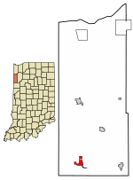
Jefferson Township, Newton County, Indiana
Northwest Indiana geography stubsTownships in IndianaTownships in Newton County, IndianaUse mdy dates from July 2023

Jefferson Township is one of ten townships in Newton County, Indiana. As of the 2010 census, its population was 2,140 and it contained 964 housing units.
Excerpt from the Wikipedia article Jefferson Township, Newton County, Indiana (License: CC BY-SA 3.0, Authors, Images).Jefferson Township, Newton County, Indiana
North 1st Street,
Geographical coordinates (GPS) Address Nearby Places Show on map
 Continue reading on Wikipedia
 Geographical coordinates (GPS)
| Latitude | Longitude |
|---|---|
| N 40.779722222222 ° | E -87.448888888889 ° |
Address
North 1st Street 974
47951
Indiana, United States
Open on Google Maps