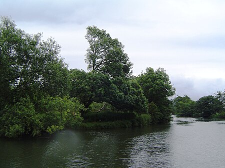
Hallsmead Ait
Berkshire geography stubsBorough of WokinghamIslands of BerkshireIslands of the River ThamesUse British English from March 2018

Hallsmead Ait is an island in the River Thames in Berkshire, England. It is on the reach above Shiplake Lock near Lower Shiplake.The island is large and triangular shaped, forming a pair with The Lynch, a similar shaped island. It is uninhabited and covered with a wide variety of trees. Although it is positioned towards the Oxfordshire bank of the river, it is actually in Berkshire.Berry Brook starts close to the Redgrave-Pinsent Rowing Lake to the southwest, running northeast through the Thames floodplain, before joining the river at Hallsmead Ait.
Excerpt from the Wikipedia article Hallsmead Ait (License: CC BY-SA 3.0, Authors, Images).Hallsmead Ait
Church Lane, South Oxfordshire
Geographical coordinates (GPS) Address Nearby Places Show on map
Geographical coordinates (GPS)
| Latitude | Longitude |
|---|---|
| N 51.4914 ° | E -0.8954 ° |
Address
Church Lane
RG9 4BS South Oxfordshire
England, United Kingdom
Open on Google Maps


