place

Buck Ait

Berkshire geography stubsBorough of WokinghamIslands of BerkshireIslands of the River ThamesUninhabited islands of England
Use British English from January 2017
BuckAit01
BuckAit01

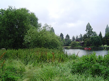
Buck Ait is an island in the River Thames in Oxfordshire, England. It is on the reach above Shiplake Lock near Sonning.The island is uninhabited and tree-covered. It lies low, acting as a water-meadow in times of flood, opposite houses with large river frontages. Its shape shows the cumulative effect of the locally curved stream, its erosion and deposition make the upstream end almost joined to the bank; the downstream end, broken into islets. The island derives its name from the eel bucks or traps that used to be placed here. Late 19th century Thames Conservancy records state they caused considerable hindrance to navigation. Eel bucks were set in St Patrick's Stream on the bank opposite upstream also; perhaps once a tributary of the mouth of the Loddon which became a distributary of a foreshortened Loddon when water levels rose by the building of Shiplake Lock and its heightened weir.Buck Ait is positioned towards the Oxfordshire bank of the river.

Excerpt from the Wikipedia article Buck Ait (License: CC BY-SA 3.0, Authors, Images).

Buck Ait
Thames Drive,

Geographical coordinates (GPS) Address Nearby Places
placeShow on map

Wikipedia: Buck AitContinue reading on Wikipedia

Geographical coordinates (GPS)

Latitude Longitude
N 51.489 ° E -0.8972 °
placeShow on map

Address

Thames Drive
RG10 9TP
England, United Kingdom
mapOpen on Google Maps

BuckAit01
BuckAit01
Share experience

Nearby Places

Shiplake
Shiplake

Shiplake consists of three settlements: Shiplake, Shiplake Cross and Lower Shiplake. Together these villages form a civil parish situated beside the River Thames 2 miles (3 km) south of Henley-on-Thames, Oxfordshire, England. The river forms the parish boundary to the east and south, and also the county boundary between Oxfordshire and Berkshire. The villages have two discrete centres separated by agricultural land. The 2011 Census records the parish (on its adjusted scale) population as 1,954 and containing 679 homes. The A4155 main road linking Henley with Reading, Berkshire passes through the parish. The largest is Lower Shiplake, centred around Shiplake railway station on the Henley Branch Line. It is the economic centre of the parish and contains a store & post office, butcher shop and The Baskerville pub, as well as most of the homes in the parish. 1 mile (1.6 km) southwest of Lower Shiplake are the older, contiguous settlements of Shiplake and Shiplake Cross. Shiplake village is the historic and religious centre of the parish and contains Shiplake Farm, the Parish church of Saint Peter & Saint Paul on Church Lane, Shiplake House, The Plough pub and Shiplake College an independent boarding school. The College occupies the building and site of the historic Shiplake Court. Shiplake village contains numerous Grade II listed buildings and monuments. Shiplake Cross is the sporting and community centre of the parish. It consists of just five roads: Memorial Avenue, Orchard Close, Plough Lane, Plowden Way and Schoolfields. It contains the Shiplake Memorial Hall, Shiplake Village Bowling Club (founded 1920) and Shiplake Tennis & Social Club as well as Shiplake CE Primary School and Nursery. Historically, the parish also included Binfield Heath, 1 mile (1.6 km) west of the historic Shiplake village. Since 2003 it has been a separate civil parish.