Frankford, Philadelphia

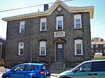
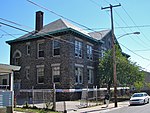
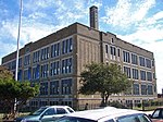
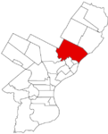
Frankford is a neighborhood in the Northeast section of Philadelphia situated about six miles (10 km) northeast of Center City. Although its borders are vaguely defined, the neighborhood is bounded roughly by the original course of Frankford Creek on the south to Castor Avenue on the southwest, to Cheltenham Avenue on the north to Torresdale Avenue on the east. Adjacent neighborhoods are Bridesburg, Kensington, Juniata, Oxford Circle, Summerdale, and Wissinoming. Historically, Frankford had an unofficial division separating Frankford (proper) from East Frankford encompassing the area east of Frankford Avenue. The division divided the community first along racial lines, with African Americans on the east of Frankford Avenue and Caucasians to the west. As the community has become less homogeneous, the division is more of a vestige of the past. In 2005, the 19124 ZIP code, which roughly contains Frankford and Juniata, had a median home sale price of $81,075, an increase of 22% over 2004.
Excerpt from the Wikipedia article Frankford, Philadelphia (License: CC BY-SA 3.0, Authors, Images).Frankford, Philadelphia
Duffield Street, Philadelphia
Geographical coordinates (GPS) Address Nearby Places Show on map
Geographical coordinates (GPS)
| Latitude | Longitude |
|---|---|
| N 40.016 ° | E -75.08 ° |
Address
Duffield Street 4781
19124 Philadelphia
Pennsylvania, United States
Open on Google Maps


