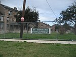
Dillard, New Orleans
Neighborhoods in New OrleansNew Orleans stubs

Dillard is a neighborhood of the city of New Orleans. A subdistrict of the Gentilly District Area, its boundaries as defined by the City Planning Commission are: Mirabeau Avenue to the north, Elysian Fields Avenue to the east, Benefit Street and I-610 to the south and Paris Avenue, Pratt Drive and the London Avenue Canal to the west.
Excerpt from the Wikipedia article Dillard, New Orleans (License: CC BY-SA 3.0, Authors, Images).Dillard, New Orleans
Warrington Drive, New Orleans
Geographical coordinates (GPS) Address Nearby Places Show on map
Geographical coordinates (GPS)
| Latitude | Longitude |
|---|---|
| N 30.000833333333 ° | E -90.068055555556 ° |
Address
Warrington Drive 416
70122 New Orleans
Louisiana, United States
Open on Google Maps


