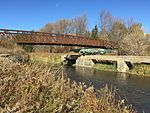
Mount Albert, Ontario
Mount Albert is a village located within the Town of East Gwillimbury and is part of York Region. It is located 65 km north-east of Toronto, 21 km south of Sutton, 45 km west-southwest of Beaverton and 30 km north of Markham. Mount Albert is accessible by Highway 404 and Highway 48. The population is currently about 4,900. Housing developments are slowly continuing north and south of the village. The downtown area is centred at Centre Street and Main Street. The town itself is bordered on the west by Highway 48, which connects Markham and Sutton, on the east by Durham Regional road 30, which serves as the townline between East Gwillimbury and Uxbridge, Doane road to the north and Herald road to the south. Vivian Creek passes through Mount Albert. The outlying area is forested mainly by private woodlots and some regionally owned and maintained pine forests while farmlands are found throughout the area. The major industry is farming (livestock, feed, and potatoes).
Excerpt from the Wikipedia article Mount Albert, Ontario (License: CC BY-SA 3.0, Authors).Mount Albert, Ontario
Stokes Road,
Geographical coordinates (GPS) Address Nearby Places Show on map
Geographical coordinates (GPS)
| Latitude | Longitude |
|---|---|
| N 44.134166666667 ° | E -79.305833333333 ° |
Address
Stokes Road 10
L0G 1M0
Ontario, Canada
Open on Google Maps


