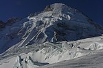
Tête Blanche
Alpine three-thousandersAosta Valley geography stubsInternational mountains of EuropeItaly mountain stubsItaly–Switzerland border ... and 5 more
Mountains of ItalyMountains of SwitzerlandMountains of ValaisMountains of the AlpsValais mountain stubs

Tête Blanche (lit. White Head, from French) is a mountain of the Pennine Alps on the Swiss-Italian border. Its summit (3,710 metres) is the tripoint between the valleys of Hérens, Mattertal (both in Valais) and Valpelline (in the Aosta Valley), thus forming the linguistic tri-point between French, German, and Italian-speaking areas. Tête Blanche is generally the high point of the Haute route between Chamonix and Zermatt and the annually race Patrouille des Glaciers. Tête Blanche lies within a few kilometres of the Matterhorn and Dent d'Hérens on the east.
Excerpt from the Wikipedia article Tête Blanche (License: CC BY-SA 3.0, Authors, Images).Tête Blanche
Geographical coordinates (GPS) Address Nearby Places Show on map
Geographical coordinates (GPS)
| Latitude | Longitude |
|---|---|
| N 45.987416666667 ° | E 7.5748611111111 ° |
Address
Bionaz
Aosta Valley, Italy
Open on Google Maps


