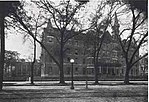
West Riverside, New Orleans
Louisiana populated places on the Mississippi RiverNeighborhoods in New OrleansNew Orleans stubs

West Riverside is a neighborhood of the city of New Orleans. A subdistrict of the Uptown/Carrollton Area, its boundaries as defined by the New Orleans City Planning Commission are: Magazine Street to the north, Napoleon Avenue to the east, the Mississippi River to the south and Exposition, Tchoupitoulas and Webster Streets to the west. This has not traditionally been a separate neighborhood as most of this area has been considered part of Uptown New Orleans throughout most of its history. This name was only artificially created by the New Orleans City Planning Commission and most residents do not identify with it.
Excerpt from the Wikipedia article West Riverside, New Orleans (License: CC BY-SA 3.0, Authors, Images).West Riverside, New Orleans
Tchoupitoulas Street, New Orleans
Geographical coordinates (GPS) Address Nearby Places Show on map
Geographical coordinates (GPS)
| Latitude | Longitude |
|---|---|
| N 29.916388888889 ° | E -90.114444444444 ° |
Address
Tchoupitoulas Street
70115 New Orleans
Louisiana, United States
Open on Google Maps


