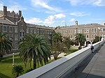
Freret, New Orleans
Neighborhoods in New OrleansNew Orleans stubs

Freret is a neighborhood of the city of New Orleans. The Freret neighborhood contains a thriving commercial corridor. A subdistrict of the Uptown/Carrollton Area, its boundaries as defined by the New Orleans City Planning Commission are: South Claiborne Avenue to the north, Napoleon Avenue to the east, LaSalle Street to the south and Jefferson Avenue to the west."Freret" is for Freret Street, which was named for William Freret, a mid-19th-century New Orleans mayor.
Excerpt from the Wikipedia article Freret, New Orleans (License: CC BY-SA 3.0, Authors, Images).Freret, New Orleans
Valence Street, New Orleans Uptown
Geographical coordinates (GPS) Address Nearby Places Show on map
Geographical coordinates (GPS)
| Latitude | Longitude |
|---|---|
| N 29.9375 ° | E -90.106944444444 ° |
Address
Valence Street 2726
70115 New Orleans, Uptown
Louisiana, United States
Open on Google Maps


