place

Le Métailler

Alpine three-thousandersMountains of SwitzerlandMountains of ValaisMountains of the AlpsValais mountain stubs
Le Metailler (16183243183)

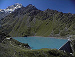
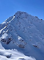
Le Métailler is a mountain of the Pennine Alps, overlooking the lake of Cleuson in the canton of Valais.

Excerpt from the Wikipedia article Le Métailler (License: CC BY-SA 3.0, Authors, Images).

Geographical coordinates (GPS)

Latitude Longitude
N 46.104027777778 ° E 7.3603333333333 °
placeShow on map

Address

Nendaz


1997
Wallis, Switzerland
mapOpen on Google Maps

Website
nendaz.ch

linkVisit website

Le Metailler (16183243183)
Share experience

Nearby Places

Mont Fort
Mont Fort

Mont Fort is a mountain of the Pennine Alps, located near Verbier in the Swiss canton of Valais. It lies on the range between the valleys of Bagnes and Nendaz, north of the Rosablanche. With a height of 3,328 metres (10,919 ft) above sea level, Mont Fort is the highest summit north of the Col de Louvie (2,921 metres (9,583 ft)). Mont Fort is surrounded by several glaciers, the largest being the Glacier de Tortin, on its northwestern side. The second largest is the Glacier du Mont Fort, located on its northeastern side. On its eastern side lies the lower summit Petit Mont Fort (3,135 metres (10,285 ft)). The Glacier du Petit Mont Fort lies between the two summits. There are no glaciers on the south side of the mountain. A small lake named Lac du Petit Mont Fort (2,764 metres (9,068 ft)) lies on the south flank. The summit of Mont Fort is easily accessible by cable car from the heights of Verbier or Nendaz. The cable cars from the two valleys converge at the intermediate station (2,894 metres (9,495 ft)) north of the Col des Gentianes, the upper section reaching a height of 3,308 metres (10,853 ft). In the winter and early spring season, the mountain, including the Glacier de Tortin, is the culminating point of the 4 Vallées ski area, accessible by the "Mont-Fort" cable car. There is one ski slope leading down from the mountain's peak - which then leads down to the Col des Gentianes, where a restaurant and two cable cars leading down to Verbier and Siviez (Haute-Nendaz) are situated.

Thyon
Thyon

Thyon (also known as Thyon 2000) is a purpose-built ski resort in the Swiss Alps, located in the canton of Valais. The resort is situated in the central part of the canton, in the region of Sion, and is associated with the village of Les Collons. It forms part of the "4 Valleys" interlinked ski area, which together includes Thyon, Veysonnaz, Haute-Nendaz, Verbier and La Tzoumaz. The ski pistes from Thyon and Veysonnaz effectively constitute a large, single integrated ski area, and connect with the rest of the "4 Valleys" area. Thyon lies at a height of 2,095 metres above sea level, on the ridge descending from Mont Rouge. The 'Thyon 2000' complex was constructed in the 1970s. Administratively, it lies in the municipality of Vex.Some of the winter ski pistes descend across what in summertime is still an active "alpage" - an area of high mountain pasture grazed by cattle, including some Combat de Reines cows. Part of the local alpage cow barn has been converted to a seasonal restaurant. The alpage dairy produces cheese from the milk, some of which is sold in the adjacent village of Les Collons during the September "désalpe" festival - the ceremonious descent of the cows, often garlanded, to lower pastures. Apart from winter sports and summer hiking, the resort has views of the Valais mountains, the so-called Pennine Alps, with direct views of six 4000+ metre peaks (Matterhorn, Dent Blanche, Obergabelhorn, Zinalrothorn, Weisshorn, Bishorn). A seventh, the Jungfrau, is visible in the Bernese Alps to the east. In August, the annual trail race from Thyon to the Grande Dixence dam takes place. This is a 16 km run with 700m ascent/descent at an altitude averaging 2,000m and attracts around 1,000 competitors.The resort is accessed by road from Sion, by chair-lifts from Les Masses and Les Collons, and by gondolas from Veysonnaz.