place

WLCQ-LP

Christian radio stations in MassachusettsContemporary Christian radio stations in the United StatesLow-power FM radio stations in MassachusettsMass media in Hampden County, MassachusettsMassachusetts radio station stubs
Radio stations established in 2006
Q Logo Standalone
Q Logo Standalone

WLCQ-LP (99.7 FM, "The Q 99.7") is a radio station licensed to serve Feeding Hills, Massachusetts. The station is owned by Lighthouse Christian Center. It airs a Christian Contemporary music format.The station was assigned the WLCQ-LP call letters by the Federal Communications Commission on June 18, 2005.

Excerpt from the Wikipedia article WLCQ-LP (License: CC BY-SA 3.0, Authors, Images).

WLCQ-LP
McKinley Street,

Geographical coordinates (GPS) Address Nearby Places
placeShow on map

Wikipedia: WLCQ-LPContinue reading on Wikipedia

Geographical coordinates (GPS)

Latitude Longitude
N 42.083055555556 ° E -72.646388888889 °
placeShow on map

Address

McKinley Street 17
01001
Massachusetts, United States
mapOpen on Google Maps

Q Logo Standalone
Q Logo Standalone
Share experience

Nearby Places

Mittineague Park
Mittineague Park

Mittineague Park is an approximately 325-acre (1.32 km2) urban park located in the southern section of the town of West Springfield, Massachusetts (In neighborhoods, Tatham and Mittineague). Mittineague derives from the Agawam Algonquian L-dialect, related to Nipmuk "muttinohkou" + "ohke" = "land on the right" (Gustafson, Holly, "A Nipmuck Grammar," Univ. Manitoba, 2008; Goddard, "Loup Languages of Western Massachusetts," Algonquian Conference, 2016; Trumbull, Natick Dictionary, Smithsonian,1905). The park contains a wide range of services typical of a park of this type, including many baseball/softball diamonds, and trails for hiking or cross-country skiing. It has a large pavilion, and a building that is used as a summer camp for children with special needs. Special events are scheduled at the park, including events for children. It contains a greenhouse and a community garden. There is an interpretive trail created by the "Friends of Mittineague Park". Native peoples were active in the area up until 400 years ago. The southwestern part of West Springfield is still called Tatham, a name derived from the Agawam name for the brook ("tattam" = someone encloses; "tattaum" = someone shakes; "taphum" = someone buys it; all in Trumbull, Natick Dictionary, Natick being closest recorded glossary according to Dr. Ives Goddard, "The Loup Languages of Western Massachusetts: Dialectical Diversity in Southern New England, Algonquian Conference 2016). The Westfield River, which runs at the outermost perimeter and most of the park's terrain was created by glaciers (the Hitchcock glacial lake/Laurentide ice sheet) as they retreated 15–20,000 years ago. Mittineague Park is home to wildlife such as hawks, beavers, frogs, foxes, fisher martens (a.k.a. Fisher Cats), and deer. The deer are most active during the winter season, and are found grazing year round in the meadows which were once part of a farm.

Agawam Center Historic District

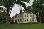
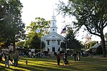
The Agawam Center Historic District is a historic district that encompasses part of the historic center of Agawam, Massachusetts. The district covers most of the buildings along Elm Street and Main Street radiating out from their intersection in both directions. The district is predominantly residential, although it does contain many commercial, industrial, and civic buildings. Many of the buildings in the district stand at a uniform setback from the street, giving the district a coherent feel.Agawam's center began to take shape in the early years of the 18th century. By 1750 the town center lay on one of the main roads connecting Northampton to Hartford, Connecticut, and the area became a significant rest stop along the way. It received significant development in the 1790s when the road was more formally laid out, private homes began to join the taverns, and what is now Elm Street connected the village to points east and west. By 1831 the center also had churches, a school, and a cemetery. The oldest building in the district is a tavern dating to 1750, and there are about a dozen houses that date to the 1790s.As the 19th century progressed the village continued to grow, yet retained some rural character, with only low levels of industrialization. The arrival of streetcars connecting the village to the city of Springfield saw the transformation of the village into one with a more suburban feel. Agawam was not formally incorporated until 1855, and it is during this time that the village assumed its role as the civic center of the town.The district features a variety of architectural styles, from Georgian and Federal buildings of the early period to mid-20th century ranch housing. The district was listed on the National Register of Historic Places in 2001.