Østmarka

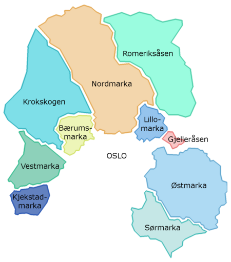
Østmarka is a forested area to the east of Oslo and part of the congregation of woodland areas known as Oslomarka. The area is situated within the municipalities Oslo, Lørenskog, Rælingen, Ski and Enebakk. Østmarka is delimited to the west by populated areas of Oslo, to the north of communities of Skårer, Lørenskog and Rælingen and to the east by the lake Øyeren, to the south-east lies Enebakk and to the south-west Sørmarka, another forested area. The change from Østmarka to Sørmarka takes place at the lake Langen. Østmarka is marked by its location on top of basement rock (more than 1 billion years old) containing easy-to-see folds that make up valleys and hills in the north-south direction. For this reason the terrain has a lot of hills, no matter where one goes. Along the upper marine border (about 210 meters) the ice of the last ice age has left large amounts of gravel and sand. Sand, Sandbakken ("Sandy Hill"), Sandbekken ("Sandy Creek") and Grusbakken ("Gravel Hill") are all on about the same elevation. The sand mines at Ødegården have been left there by the ice. Beach snails have been found at Lutvann at an elevation of 200 meters.
Excerpt from the Wikipedia article Østmarka (License: CC BY-SA 3.0, Authors, Images).Østmarka
Losbylinja, Lørenskog
Geographical coordinates (GPS) Address Nearby Places Show on map
Geographical coordinates (GPS)
| Latitude | Longitude |
|---|---|
| N 59.852058333333 ° | E 10.966413888889 ° |
Address
Tretjernhøla naturreservat
Losbylinja
1475 Lørenskog
Norway
Open on Google Maps


