place

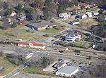
Grafton Ponds Natural Area Preserve

Protected areas of York County, VirginiaVirginia Natural Area PreservesVirginia protected area stubsYork County, Virginia geography stubs

Grafton Ponds Natural Area Preserve is a 375-acre (1.52 km2) Natural Area Preserve located in York County, Virginia. It preserves Virginia's best remaining example of a coastal plain pond complex, and supports several locally-rare species including pond spice (Litsea aestivalis), Mabee's salamander (Ambystoma mabeei), barking treefrog (Hyla gratiosa), and the globally imperiled Harper's fimbristylis (Fimbristylis perpusilla).The preserve is owned and maintained by the city of Newport News, and is open for public access.

Excerpt from the Wikipedia article Grafton Ponds Natural Area Preserve (License: CC BY-SA 3.0, Authors).

Grafton Ponds Natural Area Preserve
Bikeway,

Geographical coordinates (GPS) Address Nearby Places
placeShow on map

Wikipedia: Grafton Ponds Natural Area PreserveContinue reading on Wikipedia

Geographical coordinates (GPS)

Latitude Longitude
N 37.2 ° E -76.5375 °
placeShow on map

Address

Bikeway

Bikeway
23603 , Lee Hall
Virginia, United States
mapOpen on Google Maps

Share experience

Nearby Places

Siege of Yorktown (1862)

The Battle of Yorktown or siege of Yorktown was fought from April 5 to May 4, 1862, as part of the Peninsula Campaign of the American Civil War. Marching from Fort Monroe, Union Maj. Gen. George B. McClellan's Army of the Potomac encountered Maj. Gen. John B. Magruder's small Confederate force at Yorktown behind the Warwick Line. McClellan suspended his march up the Peninsula toward Richmond and settled in for siege operations. On April 5, the IV Corps of Brig. Gen. Erasmus D. Keyes made initial contact with Confederate defensive works at Lee's Mill, an area McClellan expected to move through without resistance. Magruder's ostentatious movement of troops back and forth convinced the Union that his works were strongly held. As the two armies fought an artillery duel, reconnaissance indicated to Keyes the strength and breadth of the Confederate fortifications, and he advised McClellan against assaulting them. McClellan ordered the construction of siege fortifications and brought his heavy siege guns to the front. In the meantime, Gen. Joseph E. Johnston brought reinforcements for Magruder. On April 16, Union forces probed a point in the Confederate line at Dam No. 1. The Union failed to exploit the initial success of this attack, however. This lost opportunity held up McClellan for two additional weeks while he tried to convince the U.S. Navy to bypass the Confederates' big guns at Yorktown and Gloucester Point, ascend the York River to West Point and outflank the Warwick Line. McClellan planned a massive bombardment for dawn on May 5, but the Confederate army slipped away during the night of May 3 toward Williamsburg. The battle took place near the site of the 1781 siege of Yorktown.

Lee's Mill Earthworks

Lee's Mill Earthworks is a historic archaeological site located at Newport News, Virginia. The earthworks formed part of the fortifications along the James River, which included fortifications at Fort Crafford, as well as, Dam No.1, and Wynne's Mill in Newport News Park. On April 5, 1862, advance units of Union Brigadier General Erasmus D. Keyes' IV Corps, under the command of Union Brigadier General William Farrar Smith, encountered Confederate units commanded by Brigadier General Lafayette McLaws at Lee's Mill. Heavy rains and massive earthen fortifications defending the river crossing stopped the Union troops from proceeding to Richmond. Confederate Major General John B. Magruder's extensive defensives beginning at Lee's Mill and extending to Yorktown along the Warwick River caused the Union Army of the Potomac Commander Major General George B. McClellan to initiate a month-long siege of the Warwick-Yorktown Line which lasted until May 3, 1862 and contributed to the eventual failure of McClellan's campaign.Lee's Mill has recently been preserved and is being transformed into a passive park with trails interpreting the fortifications. The earthen fortifications remain visible in many locations, including Newport News Park and the Lee's Mill subdivision. An active effort will be made to delineate, preserve and interpret these earthworks for the future.It was listed on the National Register of Historic Places in 2003.