Weddington, Nuneaton
Areas of NuneatonFormer civil parishes in Warwickshire

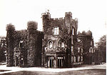
Weddington is an area of Nuneaton and former civil parish, in the Nuneaton and Bedworth district, in the county of Warwickshire, England. It bounded on the northeast by Watling Street, and on the west by the River Anker. The Ward population taken at the 2011 census was 7,256. In 1921 the parish had a population of 87.It is surrounded on the west and south by the Anker, and comprises the church, Rectory, Church Farm, the Grove, and the grounds of the former Weddington Castle. A branch road leading south from Watling Street passes through the village.
Excerpt from the Wikipedia article Weddington, Nuneaton (License: CC BY-SA 3.0, Authors, Images).Weddington, Nuneaton
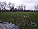
The Coppice, Nuneaton and Bedworth Weddington
Geographical coordinates (GPS) Address Nearby Places Show on map
Geographical coordinates (GPS)
| Latitude | Longitude |
|---|---|
| N 52.536 ° | E -1.465 ° |
Address
The Coppice
The Coppice
CV10 0HE Nuneaton and Bedworth, Weddington
England, United Kingdom
Open on Google Maps


