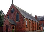
Inskip-with-Sowerby
Civil parishes in LancashireGeography of the Borough of WyreLancashire geography stubsThe FyldeUse British English from December 2021

Inskip-with-Sowerby is a civil parish in the Borough of Wyre, in Lancashire, England. A part of the Fylde, the parish includes the village of Inskip and the hamlets Crossmoor to the west and Sowerby to the east. Also Inskip Moss Side lies about a mile north-west of the village at grid reference SD452391. In 2011 it had a population of 840. The parish adjoins the Wyre parishes of Great Eccleston, Upper Rawcliffe-with-Tarnacre and Myerscough and Bilsborrow, along with Woodplumpton in the City of Preston and also Treales, Roseacre and Wharles and Elswick in the Borough of Fylde.
Excerpt from the Wikipedia article Inskip-with-Sowerby (License: CC BY-SA 3.0, Authors, Images).Inskip-with-Sowerby
Preston Road, Borough of Wyre Inskip-with-Sowerby
Geographical coordinates (GPS) Address Nearby Places Show on map
Geographical coordinates (GPS)
| Latitude | Longitude |
|---|---|
| N 53.833 ° | E -2.811 ° |
Address
Preston Road
Preston Road
PR4 0TJ Borough of Wyre, Inskip-with-Sowerby
England, United Kingdom
Open on Google Maps


