Eaves, Lancashire
Geography of the City of PrestonLancashire geography stubsThe FyldeUse British English from April 2015Villages in Lancashire

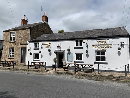
Eaves is a hamlet in Lancashire, England, six miles north of Preston. It is part of the Fylde, a flat area of land between the Forest of Bowland and the Lancashire coast. The village has a school, St. Mary and St. Andrew's Catholic Primary School, and a pub, the Plough at Eaves, which is the oldest in the Fylde. It was originally called the Cheadle Plough Inn.Eaves is in the parish of Woodplumpton.
Excerpt from the Wikipedia article Eaves, Lancashire (License: CC BY-SA 3.0, Authors, Images).Eaves, Lancashire
Preston Woodplumpton
Geographical coordinates (GPS) Address Nearby Places Show on map
Geographical coordinates (GPS)
| Latitude | Longitude |
|---|---|
| N 53.832 ° | E -2.777 ° |
Address
PR4 0DP Preston, Woodplumpton
England, United Kingdom
Open on Google Maps


