place

Winsick

Derbyshire geography stubsHamlets in DerbyshireNorth East Derbyshire District
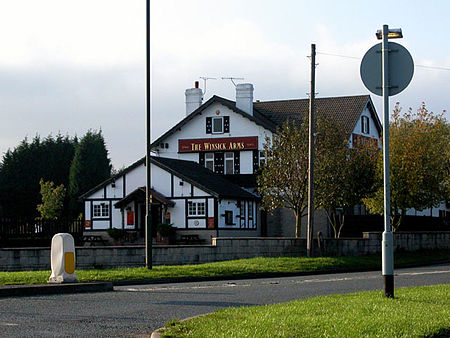
Winsick Arms Chesterfield Derbyshire

Winsick is a hamlet in Derbyshire, England. It is located on the B6039 Mansfield Road, 2 miles south of Chesterfield. It is part of the civil parish of Grassmoor, Hasland and Winsick.

Excerpt from the Wikipedia article Winsick (License: CC BY-SA 3.0, Authors, Images).

Winsick
Mansfield Road, North East Derbyshire Grassmoor, Hasland and Winswick

Geographical coordinates (GPS) Address Nearby Places
placeShow on map

Wikipedia: WinsickContinue reading on Wikipedia

Geographical coordinates (GPS)

Latitude Longitude
N 53.212 ° E -1.391 °
placeShow on map

Address

Grassmoor

Mansfield Road
S41 0JN North East Derbyshire, Grassmoor, Hasland and Winswick
England, United Kingdom
mapOpen on Google Maps

Winsick Arms Chesterfield Derbyshire
Share experience

Nearby Places

Temple Normanton
Temple Normanton

Temple Normanton is a village and a civil parish in Derbyshire, England. The population of the civil parish at the 2011 census was 490. It is in the North East Derbyshire district of the county. The village sits on a prominent hilltop three miles (5 km) south of Chesterfield. It is composed of two villages formerly known as North Normanton and Little Normanton. It is close to the villages of Heath, Holmewood, Grassmoor and the civil parish of Sutton cum Duckmanton. The Chesterfield suburb of Hasland is close by. The Manor of Normanton at the time of the Domesday Survey was in the hands of the King. Later, it passed to the Order of the Knights Templar from whom it derived its prefix 'Temple'. When the Knights Templar were dissolved in the early 14th century, the land and property of the village passed to the Order of the Hospital of St. John at Yeaveley Preceptory. Later, Henry VIII charged the Order of St. John with disloyalty, and it was dissolved. The village then passed to the hands of the crown. In 1846, Robert Arkwright was Lord of the Manor and principal owner. At the time the village had 500 acres (2.0 km2) of land, 29 houses and 132 inhabitants. In the Borough Library at Derby is held a parchment roll comprising 70 sheets stitched together. This records the proceedings of the Manor Court of Temple Normanton from 1447 to 1518. John Babbington is mentioned as a Knight of St. John, and many of the roads listed in the roll are still traceable on present day Ordnance Survey maps. Early in the industrial age the area became known for coal mining, with numerous collieries located in the vicinity. These included the massive Bonds Main Colliery which lasted from 1896 to 1949. The Chesterfield loop of the Great Central Railway also ran through the area, opened in June 1892. A Bonds Main Platform was provided for mine workers, but the nearest public station was located at Grassmoor and this closed in October 1940, the line itself closing to passenger traffic in March 1963. Sections remained for a while serving the various collieries but as these closed so the line disappeared completely. Modern Temple Normanton includes a primary school, a church, a cemetery and an MOT garage, but no shops. There are also regular buses to Chesterfield, Alfreton, Mansfield and Nottingham.

Tupton
Tupton

Tupton is a village and civil parish in North East Derbyshire, Derbyshire, England, 4.5 miles (7 km) south of Chesterfield. The population of the civil parish including Egstow and Old Tupton was at the 2011 Census 3,428. It lies just north of Clay Cross on the A61 (Derby Road) which runs from Chesterfield to Alfreton. It comprises the areas of Old Tupton and New Tupton. However, it is generally referred to as Tupton. A similarly named area, Tapton, is a few miles away, being part of Chesterfield. The village has a primary school, and a secondary school with a sixth form. Tupton also has two general stores, a post office, hair dresser, tanning studio, building supplies, tyre services, multiple garages, car repair centres, preschool nursery, three pubs, one club, a fish and chip shop, a nursing home, a coffee house and a pharmacy. Other settlements near the village are Wingerworth, Grassmoor and North Wingfield. A carnival called the Tupton Carnival is a yearly event held on a Saturday in July. This was first started in 2003 and has grown in size and attendance as the years have gone by. A young lady is elected Carnival Queen and travels through the village attended by the carnival princes and princesses and is followed by a procession of floats, bands, and fancy dress participants. The parade ends on the Primary school field for an afternoon of fun and live music, with stalls, displays, and various competitions. Tupton has also seen new development around Ankerbold Road, which runs on the outer edge of the village, close to North Wingfield. A large modern housing estate has been built around the Pond Lane proximity, as well as recent housing to the south. Tupton also has the Midland Main Line passing straight through it. At the bottom of Station New Road, there is a bridge crossing over the track into North Wingfield; this was the location of Clay Cross railway station. It is also known that Tupton has been a settlement since Anglo-Saxon times, as the historic Ryknield Street runs directly through the village. The locality was formerly known as "Topetune" and "Tuphome." Tupton is shown on the C. Smith New Map of Great Britain and Ireland in 1806 and on the first Ordnance Survey maps, Tupton Moor, Tupton Over Wood and Tupton Hall are shown.