place

Tupton

AC with 0 elementsNorth East Derbyshire DistrictTowns and villages of the Peak DistrictVillages in Derbyshire
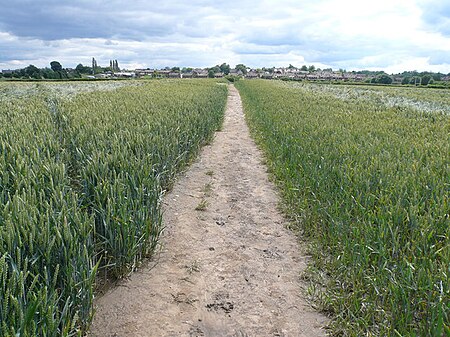
Avenue Washlands Nature Reserve

Tupton is a village and civil parish in North East Derbyshire, Derbyshire, England, 4.5 miles (7 km) south of Chesterfield. The population of the civil parish including Egstow and Old Tupton was at the 2011 Census 3,428. It lies just north of Clay Cross on the A61 (Derby Road) which runs from Chesterfield to Alfreton. It comprises the areas of Old Tupton and New Tupton. However, it is generally referred to as Tupton. A similarly named area, Tapton, is a few miles away, being part of Chesterfield. The village has a primary school, and a secondary school with a sixth form. Tupton also has two general stores, a post office, hair dresser, tanning studio, building supplies, tyre services, multiple garages, car repair centres, preschool nursery, three pubs, one club, a fish and chip shop, a nursing home, a coffee house and a pharmacy. Other settlements near the village are Wingerworth, Grassmoor and North Wingfield. A carnival called the Tupton Carnival is a yearly event held on a Saturday in July. This was first started in 2003 and has grown in size and attendance as the years have gone by. A young lady is elected Carnival Queen and travels through the village attended by the carnival princes and princesses and is followed by a procession of floats, bands, and fancy dress participants. The parade ends on the Primary school field for an afternoon of fun and live music, with stalls, displays, and various competitions. Tupton has also seen new development around Ankerbold Road, which runs on the outer edge of the village, close to North Wingfield. A large modern housing estate has been built around the Pond Lane proximity, as well as recent housing to the south. Tupton also has the Midland Main Line passing straight through it. At the bottom of Station New Road, there is a bridge crossing over the track into North Wingfield; this was the location of Clay Cross railway station. It is also known that Tupton has been a settlement since Anglo-Saxon times, as the historic Ryknield Street runs directly through the village. The locality was formerly known as "Topetune" and "Tuphome." Tupton is shown on the C. Smith New Map of Great Britain and Ireland in 1806 and on the first Ordnance Survey maps, Tupton Moor, Tupton Over Wood and Tupton Hall are shown.

Excerpt from the Wikipedia article Tupton (License: CC BY-SA 3.0, Authors, Images).

Tupton
Queen Victoria Road, North East Derbyshire

Geographical coordinates (GPS) Address Nearby Places
placeShow on map

Wikipedia: TuptonContinue reading on Wikipedia

Geographical coordinates (GPS)

Latitude Longitude
N 53.19051 ° E -1.40729 °
placeShow on map

Address

Queen Victoria Road

Queen Victoria Road
S42 6BJ North East Derbyshire
England, United Kingdom
mapOpen on Google Maps

Avenue Washlands Nature Reserve
Share experience

Nearby Places

Clay Cross railway station

Clay Cross railway station was a railway station built by the North Midland Railway in 1840. It served the town of Clay Cross in Derbyshire, England. It was originally planned to have been built within the Clay Cross Tunnel, however it was clear that it would be impossible to ventilate it effectively, so instead it was built at the northern entrance - nearer to Tupton. The original station was the usual Francis Thompson Italianate design. The station was the site of a fatal accident on 19 May 1851 which left 2 people dead and 16 injured. The locomotive of a passenger train which left Derby at 9.05pm for Leeds suffered a broken pump-rod. The driver stopped near Clay Cross station to remove the broken part and the rear of his train was hit by a goods train and smashed into the last two carriages. At an inquest, the jury reached a verdict of manslaughter against the driver of the goods train, Samuel Stretton, but also condemned the railway company practice of allowing a goods train to follow a passenger train with a gap of only 5 minutes, the lack of a night signal man at Clay Cross, and the regular practice of allowing trains to stop at stations which were not intended in the timetable.The Erewash Valley line opened on 1 May 1862 and had its northernmost connection at Clay Cross.In 1877 the Midland Railway went out to tender for the rebuilding of the station. The alterations for the additional traffic resulting from the Erewash Valley Line were completed by January 1878. A link line from Clay Cross South Junction to Clay Cross North Junction comprised a double line each for goods and passenger traffic from the Sheffield junction at Tapton, north of Chesterfield, to the junction of the Erewash Valley branch south of Clay Cross. The station was rebuilt in the Midland Railway styles and the platforms were improved. An additional platform was added for the Erewash Valley trains. Three large platforms were opened, one outside the outer lines and a large on in the centre, connected by covered staircases and bridges so as to enable passengers to cross the line in safety. The station closed in 1967. There are no visible remains. However the goods shed still remains on the south side of the bridge. North of Clay Cross, there developed very busy coal sidings, particularly those serving the Avenue Coal Carbonisation Plant. A locomotive shed was built at Hasland in 1861 with at one time as many as sixty engines. In the 1960s it supported sixteen Garratt 2-6-0+0-6-2 locomotives used for the coal traffic from Yorkshire. The next station northwards was at Chesterfield.