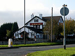
Hasland
Chesterfield, DerbyshireEngvarB from June 2016Incomplete lists from August 2013Villages in DerbyshireWikipedia indefinitely move-protected pages

Hasland is a suburb in the south-east of Chesterfield, Derbyshire, England. Hasland is located south of Spital, east of Birdholme and north of Grassmoor. Hasland is a ward of the Borough of Chesterfield. The ward population at the 2011 Census was 6,969. The A617 (Hasland By-Pass) links Hasland, along with Chesterfield, to the M1. Historically a village, it expanded greatly during the 20th century and now forms part of Chesterfield itself. The expansion of Hasland has created a dense array of shops and services, including: a theatre, three schools, three churches, two medical centres and a couple of industrial buildings.
Excerpt from the Wikipedia article Hasland (License: CC BY-SA 3.0, Authors, Images).Hasland
Mansfield Road,
Geographical coordinates (GPS) Address Nearby Places Show on map
Geographical coordinates (GPS)
| Latitude | Longitude |
|---|---|
| N 53.2203 ° | E -1.4065 ° |
Address
Ladbrokes
Mansfield Road
S41 0JA , Spital
England, United Kingdom
Open on Google Maps


