place

Knight Estate

1830 establishments in Rhode IslandCommunity College of Rhode IslandHouses completed in 1830Houses in Warwick, Rhode IslandHouses on the National Register of Historic Places in Rhode Island
National Register of Historic Places in Kent County, Rhode Island
Knight Estate in Warwick RI

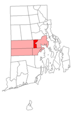
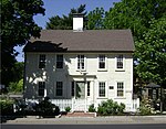
The Knight Estate is a historic estate in Warwick, Rhode Island, that is home to the Knight Campus of the Community College of Rhode Island. Developed as a country estate for a family of industrialists and later donated to the state, the main house and its outbuildings were listed on the United States National Register of Historic Places in 1984.

Excerpt from the Wikipedia article Knight Estate (License: CC BY-SA 3.0, Authors, Images).

Knight Estate
East Avenue, Warwick

Geographical coordinates (GPS) Address Nearby Places
placeShow on map

Wikipedia: Knight EstateContinue reading on Wikipedia

Geographical coordinates (GPS)

Latitude Longitude
N 41.717372 ° E -71.480768 °
placeShow on map

Address

East Avenue

East Avenue
02996 Warwick
Rhode Island, United States
mapOpen on Google Maps

Knight Estate in Warwick RI
Share experience

Nearby Places

East Natick, Rhode Island

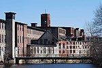
East Natick is a small village in Warwick, Rhode Island. It is centered on the intersection of Bald Hill Road and East Avenue. The village is separated from Natick proper by the railroad (now the Washington Secondary Trail), and the Pawtuxet River. The other nearby village is Pontiac, which is northerly across the Pawtuxet. East Natick was home to many industrial workers, who worked in the mills of nearby Natick. Examples of traditional Rhode Island mill housing can be seen in the northerly part in the village. One of the most interesting buildings here is that of the Warwick Ice Cream Company, founded 1930. Built in 1940, it is one of only a few examples of Art Deco architecture in Warwick. It was designed by Providence architect Francis Chiaverini. There is a colonial era farmhouse at 697 East Avenue. East Natick is home to two prominent Rhode Island institutions: the Community College of Rhode Island and the Rhode Island Mall. CCRI is located on the grounds of the former Knight Estate, owned by first the Spragues and then the Knights, major manufacturing families. The main house, still standing at 486 East Avenue, is believed to have been built by William Sprague between 1827 and his death in 1836. The estate was later donated to the state, and the Rhode Island Junior College, now CCRI, opened there in 1972. The Rhode Island Mall, originally the Midland Mall, opened in 1967. Much of the building is currently vacant.

Warwick Mall

Warwick Mall is an enclosed American shopping mall in Warwick, Rhode Island, on the north side of Interstate 295 near the junction with Interstate 95. Composed of more than 1,000,000 square feet (93,000 m2) of retail space, it features more than 80 stores and a food court. The mall opened for business in 1970, with Boston-based Filene's and Jordan Marsh alongside Providence-based Peerless and The Outlet, and national chain Woolworth as initial anchors, JCPenney being later added as a sixth anchor. Since then, all the anchor stores and the interior of the mall have changed as a result of business closings and consolidations. Today, the mall has seven main anchors: Macy's on the northern side, Old Navy and JCPenney on the western side, Jordan's Furniture and Nordstrom Rack on the eastern side, and Target, Off Broadway Shoes, and Golf Galaxy on the southern side. The mall also has a large food court, complete with a carousel, in the former Peerless anchor space. The mall was largely flooded on March 30, 2010, during historic flooding of the nearby Pawtuxet River. The mall closed for five months after the flooding, with its "Preview" beginning in August and the Grand Reopening in October. The mall's final anchor, Macy's, reopened on March 16, 2011, and just over a month later, Jordan's Furniture announced on April 20, 2011 that it will open a new store in the vacated Old Navy and Caldor anchor space on the east side of the mall.

Rhode Island
Rhode Island

Rhode Island ( (listen), like road) is a state in the New England region of the Northeastern United States. It is the smallest U.S. state by area and the seventh-least populous, with slightly less than 1.1 million residents as of 2020; but Rhode Island has grown at every decennial count since 1790 and is the second-most densely populated state, after New Jersey. The state takes its name from the eponymous island, though nearly all of its land area is on the mainland. Rhode Island borders Connecticut to its west; Massachusetts to its north and east; and the Atlantic Ocean to its south via Rhode Island Sound and Block Island Sound; and shares a small maritime border with New York, east of Long Island. Providence is its capital and most populous city. Native Americans lived around Narragansett Bay for thousands of years before English settlers began arriving in the early 17th century. Rhode Island was unique among the Thirteen British Colonies in having been founded by a refugee, Roger Williams, who fled religious persecution in the Massachusetts Bay Colony to establish a haven for religious liberty. He founded Providence in 1636 on land purchased from local tribes, thereby creating the first settlement in North America with an explicitly secular government. The Colony of Rhode Island and Providence Plantations subsequently became a destination for religious and political dissenters and social outcasts, earning it the moniker "Rogue's Island".Rhode Island was the first colony to call for a Continental Congress, which it did in 1774, and the first to renounce its allegiance to the British Crown, which it did on May 4, 1776. After the American Revolution, during which it was heavily occupied and contested, Rhode Island became the fourth state to ratify the Articles of Confederation, which it did on February 9, 1778. Because its citizens favored a weaker central government, it boycotted the 1787 convention that had drafted the United States Constitution, which it initially refused to ratify; it finally did ratify it on May 29, 1790, the last of the original 13 states to do so.The state was officially named the State of Rhode Island and Providence Plantations since the colonial era, but came to be commonly known as "Rhode Island". In November 2020, the state's voters approved an amendment to the state constitution formally dropping "and Providence Plantations" from its full name. Its official nickname is the "Ocean State", a reference to its 400 mi (640 km) of coastline and the large bays and inlets that make up about 14% of its total area.

Apponaug, Rhode Island

Apponaug is a neighborhood in central Warwick, Rhode Island, United States, situated on Apponaug Cove, a tributary to Greenwich Bay and nearby Narragansett Bay. The name Apponaug is a derivation of the Narragansett Indian word for "place of oysters". Indeed, Apponaug Cove holds one of the richest shellfish beds in the United States and was densely populated by the Narragansett people for many centuries prior to the arrival of European settlers. Apponaug consists of what is effectively a large rotary. In the 1960s, the Rhode Island Department of Transportation was in need of a faster way to feed the increasing number of cars through Apponaug that were en route to West Shore Road and other locations. Traffic patterns were rerouted in what was supposed to be a temporary solution, creating a one-way hub in the center of the village.Apponaug is located at the intersection of three of Warwick's primary streets: Post Road (U.S. Route 1), Greenwich Avenue (R.I. Route 5), and Centerville Road (R.I. Route 117). It is considered downtown or central Warwick, as Warwick City Hall is located here, plus police and fire headquarters, the Apponaug branch of the Warwick Public Library, a museum, and the post office. The cluster of municipal buildings in the center of Apponaug is designated as the Warwick Civic Center Historic District, while a cluster of stately homes in the southern part of the neighborhood is designated as the Apponaug Historic District.