place

Hillsdale Historic and Archeological District

Historic districts in Washington County, Rhode IslandHistoric districts on the National Register of Historic Places in Rhode IslandNRHP infobox with nocatNational Register of Historic Places in Washington County, Rhode IslandRichmond, Rhode Island
Use mdy dates from August 2023Washington County, Rhode Island Registered Historic Place stubs
HILLS DALE HISTORIC AND ARCHEOLOGICAL DISTRICT, WASHINGTON COUNTY

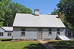
Hillsdale Historic and Archeological District is a historic district in Richmond, Rhode Island. The district was added to the National Register of Historic Places in 1980. It represents the site of the former textile mill village of Hillsdale. Hillsdale is located on the Beaver River, and was originally known as Moore's Mills. It was the site of a grist mill built around 1800, followed by a wool-carding mill established in 1828. Later the carding mill was converted to the manufacture of "Negro cloth." By the end of the 19th century, industrial activity in Hillsdale had ceased. As of 1977, the site contained a few old houses, the stone ruins of the textile mill, and a mill pond.

Excerpt from the Wikipedia article Hillsdale Historic and Archeological District (License: CC BY-SA 3.0, Authors, Images).

Hillsdale Historic and Archeological District
Oakland Road,

Geographical coordinates (GPS) Address External links Nearby Places
placeShow on map

Wikipedia: Hillsdale Historic and Archeological DistrictContinue reading on Wikipedia

Geographical coordinates (GPS)

Latitude Longitude
N 41.521916666667 ° E -71.640833333333 °
placeShow on map

Address

Hillsdale Historic and Archeological District

Oakland Road
02898
Rhode Island, United States
mapOpen on Google Maps

linkWikiData (Q5763799)
linkOpenStreetMap (5448639)

HILLS DALE HISTORIC AND ARCHEOLOGICAL DISTRICT, WASHINGTON COUNTY
Share experience

Nearby Places

Chariho Regional School District

Chariho is a regional school district located in southern Rhode Island shared by three adjacent towns; Charlestown, Richmond, and Hopkinton. The name Chariho is a portmanteau derived by taking the first two letters from each town name and combining them together. The district operates four elementary schools, two of which are located in Hopkinton, in the villages of Ashaway and Hope Valley, one in Charlestown, and one in Richmond. The Chariho campus located in the Richmond village of Wood River Junction houses the Middle and High Schools, as well as the Chariho Career And Technical Center. Chariho Regional Junior-Senior High School (its full name) opened in the fall of 1960; prior to that year, students attended schools in nearby South Kingstown or Westerly. The first class to attend the school for all six grades was the class of 1966. That same year, Chariho won the Rhode Island Interscholastic League statewide baseball championship. Enrollment of the High School is around 1200 students including 430 in the Career and Technical school (as of 2012). Students from surrounding districts can attend the Chariho Career And Technical Center. The Chariho Act is the legislation governing the regional school district. Each town contributes taxes proportionally based on student enrollment. The name Chariho is also often used to describe the region including its three towns, as a number of local organizations and businesses have used the name.