place

Cratley

Deserted medieval villages in NottinghamshireEngvarB from May 2016Newark and SherwoodNottinghamshire geography stubs
Field North Laiths For Infobox

Cratley is a lost village in Nottinghamshire, England. It may have been located close to North Laithes Farm at Kneesall although an alternative site east of Laund Wood has been suggested. Another name's for the settlement is Cratela, or Creilage. Two field names on the Estate Map of the Liberty of Rufford i.e. (Rufford Estate) in 1637 are given as East and West Credlin. The Village of Cratley was listed as Crastell in the Domesday Book as having 22 villeins and 2 bordars, i.e. 22 villagers, 2 smallholders. 4 Ploughlands. 2 Lord's Plough Teams for the Demesne Lands of the Manor. and 9 Men's Plough Teams. Each Ploughteam had 8 Oxons. Total population in 1086 was 24 households (quite large), Total tax paid by all the owners: 2.5 geld According to the Domesday Book Tax was paid on 26 Acres of Demense Meadow Land, and 0.5 leagues of WoodlandLord of the Manor in 1066: Ulf Fenman. Value to the Lord was in 1066 £6. [Lord of the Manor in 1086: Gilbert de Gant, who was a Tenant-in-chief of the capital manor, held directly of the Crown. Head of the Manor: Wellow. which makes Cratley a Sub Manor of the Lordship of Wellow in Nottinghamshire, England. Soon after the foundation of Rufford Abbey by Gilbert de Gant, on 12 July 1147,The Village of Cratley was reduced to a grange and the villagers gradually evicted and resettled at Wellow.

Excerpt from the Wikipedia article Cratley (License: CC BY-SA 3.0, Authors, Images).

Cratley
Eakring Road, Newark and Sherwood

Geographical coordinates (GPS) Address Nearby Places
placeShow on map

Wikipedia: CratleyContinue reading on Wikipedia

Geographical coordinates (GPS)

Latitude Longitude
N 53.17 ° E -0.95 °
placeShow on map

Address

Eakring Road

Eakring Road
NG22 0AG Newark and Sherwood
England, United Kingdom
mapOpen on Google Maps

Field North Laiths For Infobox
Share experience

Nearby Places

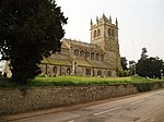
Kneesall

Kneesall is a village and civil parish in the East Midlands of England in the county of Nottinghamshire. The population of the civil parish at the 2011 census was 221. Forming part of the Newark and Sherwood district, Kneesall is situated on the A616 between Newark-on-Trent and Ollerton. The village is three miles from neighbouring Eakring and four miles from Laxton. Kneesall has a small C of E primary school teaching children from many of the surrounding villages, and making up a part of the 3KANDO network, along with Averham, and Dean Hole C of E Primary. Kneesall was once well known for its one pub, The Angel Inn. The Angel has changed management multiple times in the last decade, most recently reopening in summer 2014. Though having no shops, the village did have a post office, that was closed in 1995. The centre of the villages activities are in the Church, which in 2004 was partly converted into the Bill Helmsley Community Centre, which continues to host local clubs and many events. Kneesall is home to Old Hall, built c. 1515–1540 and likely to be the oldest brick building in Nottinghamshire.There was a windmill beside the Newark Road, marked on a 1774 map, which replaced an earlier mill known as Mettam's Mill. In 1795 the mill belonged to William Taylor.Though Kingston farm has not been active in Kneesall since 2003, Kneesall is surrounded by open fields that are still farmed by a contractor producing crops such as wheat and rape seed, and still has a dairy farm, providing milk for local villages. The village, though having a 30 mph speed limit throughout, has seen many car accidents, some of which have been fatal.