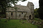
Miserden

Miserden is a village and civil parish in Stroud District, Gloucestershire, England, 4 miles north east of Stroud. The parish includes Whiteway Colony and the hamlets of Sudgrove and The Camp. In the 2001 census the parish had a population of 420, increasing to 449 at the 2011 census.The village lies in the Cotswolds at an elevation of over 800 ft, above the valley of the River Frome. Until the Middle Ages, Miserden was known as Greenhampstead, and was mentioned by that name in the Domesday Book. The name Miserden derives from Musardera, "Musard's manor" - Musard was the name of the family which held the manor at the time of the Domesday Book. Robert Musard built Miserden Castle in the 12th century.
Excerpt from the Wikipedia article Miserden (License: CC BY-SA 3.0, Authors, Images).Miserden
Miserden Park Lane,
Geographical coordinates (GPS) Address Nearby Places Show on map
Geographical coordinates (GPS)
| Latitude | Longitude |
|---|---|
| N 51.783333333333 ° | E -2.1 ° |
Address
Miserden Park Lane
Miserden Park Lane
GL6 7JA
England, United Kingdom
Open on Google Maps


