place

Pearl Street (Manhattan)

Beaches of New York (state)Financial District, ManhattanNew York City road stubsPiers in New York CityShell middens in the United States
Source attributionStreets in Manhattan
Frauncestavern
Frauncestavern

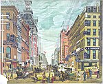
Pearl Street is a street in the Financial District in Lower Manhattan, running northeast from Battery Park to the Brooklyn Bridge with an interruption at Fulton Street, where Pearl Street's alignment west of Fulton Street shifts one block south of its alignment east of Fulton Street, then turning west and terminating at Centre Street.

Excerpt from the Wikipedia article Pearl Street (Manhattan) (License: CC BY-SA 3.0, Authors, Images).

Pearl Street (Manhattan)
Pearl Street, New York Manhattan

Geographical coordinates (GPS) Address Nearby Places
placeShow on map

Wikipedia: Pearl Street (Manhattan)Continue reading on Wikipedia

Geographical coordinates (GPS)

Latitude Longitude
N 40.707095987642 ° E -74.006275853283 °
placeShow on map

Address

Courtyard & Residence Inn by Marriott

Pearl Street 215
10038 New York, Manhattan
New York, United States
mapOpen on Google Maps

Frauncestavern
Frauncestavern
Share experience

Nearby Places

Hague Street explosion

The Hague Street explosion occurred on February 4, 1850, in New York City, when a boiler exploded at a printing press manufacturer. The blast killed at least 67 people, injured around 30, and sent thousands running into the streets. According to news reports at the time, the head of the boiler was carried up through all six of the building's stories and finally tore off the building's roof, while the building itself lifted six to seven feet (1.8 to 2.1 m) in the air, causing it to collapse in on itself. One report stated, The windows and doors across Hague Street, and in the rear of houses [on] Pearl Street, were burst in as if with cannon shot, and everything around indicates that the explosion was one of the most violent that could occur. So powerful was the explosion that the shock, like the trembling of an earthquake, was felt in some of the stores [on] Broadway, a distance, in a direct line, of about a quarter of a mile, and was probably felt at a greater distance. The rescue effort was led by New York City Mayor Caleb Smith Woodhull and the New York City Police Department, with assistance from the fire department. About 100 rescuers were divided into three teams, working in shifts. The last person to be rescued was a young boy who had been trapped for 17 hours under a mass of wood and iron beams. The boy died of burn injuries shortly after his rescue; his story featured prominently in newspaper reports of the day.

70 Pine Street
70 Pine Street

70 Pine Street – formerly known as the 60 Wall Tower, Cities Service Building, and American International Building – is a 67-story, 952-foot (290 m) residential building in the Financial District of Lower Manhattan in New York City. It was designed by the firm of Clinton & Russell, Holton & George in the Art Deco style. 70 Pine Street, built in 1930–1932 by energy conglomerate Cities Service Company (later Citgo), was Lower Manhattan's tallest building and the world's third-tallest structure upon its completion. 70 Pine Street occupies a trapezoidal lot on Pearl Street between Pine and Cedar Streets. It features a brick, limestone, and gneiss facade with numerous setbacks. The building contains an extensive program of ornamentation, including the Cities Service Company's triangular logo and solar motifs. The interior features included escalators at the base and double-deck elevators linking the tower's floors. A three-story penthouse, intended for Cities Service's founder Henry Latham Doherty, was later utilized as a public observatory. 70 Pine Street's construction was funded through a public offering of stock, rather than a mortgage loan. Despite having been built during the Great Depression, the building was profitable enough that it broke even by 1936, with 90% of the space occupied five years later. The American International Group (AIG) bought the building in 1976, and it was acquired by another firm in 2009 after AIG went into bankruptcy. The building and its first floor interior were designated as official New York City landmarks in June 2011. In 2016, the building became a luxury rental residential property.

Louise Nevelson Plaza

Louise Nevelson Plaza (formerly known as Legion Memorial Square), is a public art installation and park in Lower Manhattan, New York City, which includes an arrangement of large abstract sculptures designed by the American 20th-century female artist Louise Nevelson. Described as an "outdoor environment", the triangle-shaped plaza is bounded by Maiden Lane, Liberty Street and William Street, adjacent to the building of the Federal Reserve Bank of New York. The original site, created to display seven large-scale abstract sculptures commissioned from Nevelson by New York City, opened in 1977 as Legion Memorial Square. Officially inaugurated as Louise Nevelson Plaza in 1978, it marked the city's first public space named after and designed by a living artist.: 90  The plaza, while suffering from poor maintenance, remained mostly unchanged for many years. However, following the September 11 attacks in 2001, a security booth was installed, the first deviation from Nevelson's original design. By 2007, faded sculptures and required sub-surface repairs led to a comprehensive redesign by the Lower Manhattan Development Corporation, the New York City Department of Transportation, and the New York City Department of Design and Construction. Reopened in 2010, the updated plaza featured new ground cover, an elevated platform, benches, plantings, and rearranged, restored Nevelson sculptures. Despite criticism from some art historians for altering the original concept, Louise Nevelson's granddaughter Maria Nevelson supported the renovations, citing her grandmother's embrace of the "now" over the past.