place

Bay Island

AC with 0 elementsBodies of water of Virginia Beach, VirginiaCoastal islands of VirginiaCommunities in Virginia Beach, VirginiaHampton Roads, Virginia geography stubs

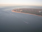
Bay Island is a two mile long island situated in the North Great Neck area of Virginia Beach, Virginia. The island is bordered by Long Creek to the north and Broad Bay to the south, both offshoots of the Lynnhaven River, and is connected to the mainland by the West Great Neck Bridge on the western side of the island. The island traditionally contains two residential neighborhoods: Broad Bay Colony on the western side of the island and Bay Island on the eastern side, although most residents just refer to the entire residential area as Bay Island. The two neighborhoods share a homeowners' association as well as several other community clubs, such as the Garden Club. Children in the neighborhood attend three schools depending on grade level: John B. Dey Elementary School, Great Neck Middle School, and Frank W. Cox High School. The island is susceptible to flooding, especially on the northern and western sides of the island. Due to this, even small hurricanes or tropical storms may cause the need for an entire evacuation of the island, as the roads on the western side flood, blocking the only exit from the island. This can happen even when the rest of Virginia Beach is not affected by a storm.

Excerpt from the Wikipedia article Bay Island (License: CC BY-SA 3.0, Authors).

Bay Island
Spindrift Road, Virginia Beach

Geographical coordinates (GPS) Address Nearby Places
placeShow on map

Wikipedia: Bay IslandContinue reading on Wikipedia

Geographical coordinates (GPS)

Latitude Longitude
N 36.908888888889 ° E -76.048888888889 °
placeShow on map

Address

Spindrift Road 2400
23451 Virginia Beach
Virginia, United States
mapOpen on Google Maps

Share experience

Nearby Places

First Landing State Park

First Landing State Park (formerly Seashore State Park) offers recreational opportunities at Cape Henry in the independent city of Virginia Beach, Virginia. As the first planned state park of Virginia, First Landing is listed on the National Register of Historic Places as Seashore State Park Historic District. A portion of the park is listed as a National Natural Landmark as part of the Seashore Natural Area. The state park is near the site of the first landing on April 26, 1607 of Christopher Newport and the Virginia Company colonists before establishing themselves at Jamestown. The park includes cabins, areas for camping, fishing, and swimming, a public beach, and over 19 miles (31 km) of trails for hiking and biking. Virginia's most popular state park, it's visited by over a million people each year. Its main entrance is located on Shore Drive across from the beach camping entrance. First Landing State Park charges a fee for its camping facilities and for the overnight use of its cabins. Originally built by the Civilian Conservation Corps in the 1930s, First Landing State Park is located on the Chesapeake Bay. The park, which is Virginia's most visited state park, is nestled in Virginia Beach. First Landing offers boating, swimming, nature and history programs, hiking, biking, picnicking, a boat launch, cabins and 19 miles (31 km) of trails on 2,888 acres (11.69 km2). It also has campsites that have water and electric hook-ups and nearby access to restrooms and showers. The park's name was changed in 1997 from Seashore State Park to First Landing State Park to reflect its heritage as the first place where members of the Virginia Company landed (though its former name is still commonly used by Tidewater locals).