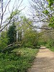
Crouch Hill
London road stubsStreets in the London Borough of HaringeyStreets in the London Borough of IslingtonUse British English from June 2015

Crouch Hill is a street in north London, England, running between Crouch End and Stroud Green in the boroughs of Haringey and Islington. It is not to be confused with Crouch End Hill which runs between Crouch End and Hornsey Rise. (The two roads meet at a "y" junction in Crouch End and together the two routes constitute the southern access to Crouch End Broadway). The street has a railway station of the same name on the Islington (south) slope of the hill, which is served by the Gospel Oak to Barking line. It is served by London Buses route W7.
Excerpt from the Wikipedia article Crouch Hill (License: CC BY-SA 3.0, Authors, Images).Crouch Hill
Stanhope Road, London Crouch End (London Borough of Haringey)
Geographical coordinates (GPS) Address Nearby Places Show on map
Geographical coordinates (GPS)
| Latitude | Longitude |
|---|---|
| N 51.574166666667 ° | E -0.12138888888889 ° |
Address
Parkland Walk Local Nature Reserve
Stanhope Road
N6 5NE London, Crouch End (London Borough of Haringey)
England, United Kingdom
Open on Google Maps


