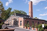
Jones Falls

The Jones Falls is a 17.9-mile-long (28.8 km) stream in Maryland. It is impounded to create Lake Roland before running through the city of Baltimore and finally emptying into the Baltimore Inner Harbor. The Jones Falls valley has a long history in the city of Baltimore as a transportation corridor. The valley of the Jones Falls carries Falls Road (which is numbered as Maryland Route 25), the tracks for the Amtrak Northeast Corridor, the Jones Falls Expressway (JFX) of Interstate 83, and the Baltimore Light Rail. The Baltimore Penn Station also rests on an elevated platform in the valley. It also carries tracks for a historic rail line which is currently served by the Baltimore Streetcar Museum. The MTA Maryland Route 27 also provides transportation on Falls Road; however, at some point it was moved from following 36th Street south to other city streets. The Jones Falls is spanned by many bridges within Baltimore City's borders, and often the Jones Falls Expressway rests directly above the river.
Excerpt from the Wikipedia article Jones Falls (License: CC BY-SA 3.0, Authors, Images).Jones Falls
Union Avenue, Baltimore Park Heights
Geographical coordinates (GPS) Address Nearby Places Show on map
Geographical coordinates (GPS)
| Latitude | Longitude |
|---|---|
| N 39.335416666667 ° | E -76.645777777778 ° |
Address
Union Avenue 1770
21211 Baltimore, Park Heights
Maryland, United States
Open on Google Maps


