Aiguille de la Tsa
Alpine three-thousandersMountains of SwitzerlandMountains of ValaisMountains of the AlpsValais mountain stubs

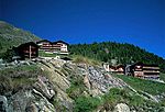
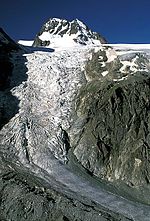
The Aiguille de la Tsa is a mountain of the Swiss Pennine Alps, overlooking Arolla in the canton of Valais. It lies on the range culminating at the Dent de Perroc, between the valley of Arolla and the Mont Miné Glacier.
Excerpt from the Wikipedia article Aiguille de la Tsa (License: CC BY-SA 3.0, Authors, Images).Aiguille de la Tsa
Geographical coordinates (GPS) Address Nearby Places Show on map
Geographical coordinates (GPS)
| Latitude | Longitude |
|---|---|
| N 46.021388888889 ° | E 7.5222222222222 ° |
Address
Evolène
1983
Wallis, Switzerland
Open on Google Maps


