place

Estadio BBVA

2026 FIFA World Cup StadiumsFootball venues in MexicoSports venues completed in 2015Sports venues in Monterrey
Estadio BBVA Bancomer (1)

The Estadio BBVA, nicknamed "El Gigante de Acero" (Spanish for "The Steel Giant"), formerly known as the Estadio BBVA Bancomer, is a stadium developed by FEMSA and C.F. Monterrey in Guadalupe, Greater Monterrey. The stadium replaced the Estadio Tecnológico as the home of Monterrey, ending 63 years of residency at that stadium. The project was met with controversy, stemming from multiple accusations of the construction as an apparent impediment to wildlife growth on a local scale by deforesting 24.5 hectares of forest neighboring a natural protected area that houses 106 animal species, including 8 endangered or protected species such as the yellow headed parrot. It was inaugurated on 2 August 2015 with the eighth edition of the Eusébio Cup, where Monterrey defeated Benfica 3–0. The stadium is expected to host matches for the 2026 FIFA World Cup.

Excerpt from the Wikipedia article Estadio BBVA (License: CC BY-SA 3.0, Authors, Images).

Estadio BBVA
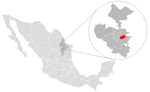
Avenida Pablo Livas, Guadalupe

Geographical coordinates (GPS) Address External links Nearby Places
placeShow on map

Wikipedia: Estadio BBVAContinue reading on Wikipedia

Geographical coordinates (GPS)

Latitude Longitude
N 25.669166666667 ° E -100.24444444444 °
placeShow on map

Address

Estadio BBVA (El Coloso de La Pastora)

Avenida Pablo Livas
67176 Guadalupe
Nuevo León, Mexico
mapOpen on Google Maps

linkWikiData (Q3058827)
linkOpenStreetMap (346397099)

Estadio BBVA Bancomer (1)
Share experience

Nearby Places

Guadalupe, Nuevo León

Guadalupe is a city and surrounding municipality located in the state of Nuevo León, in northern Mexico. It is part of the Greater Monterrey Metropolitan area. The municipality of Guadalupe, which lies adjacent to the east side of Monterrey, also borders the municipalities of San Nicolás de los Garza, Apodaca, Pesquería, and Juárez. Covering a territory of 151.3 km2 (58.4 sq mi), it is located at 25°40′39″N 100°15′35″W, at an altitude of 500 meters above sea level. As of the 2005 census its official population was 691,434 in the city and 691,931 in the entire municipality. It is the second-largest city and municipality in the state. The municipality has an area of 151.3 km2 (58.4 sq mi) (58.42 sq mi). The city was founded on January 4, 1716, but the land was inhabited long before that. When Monterrey was founded in 1596, the land, which was populated by various indigenous tribes, was ceded to Diego de Montemayor, the founder of Monterrey, but he did not make use of the land. In 1627, the land was turned into large plantations, where sugar cane and corn was raised. The owner of the land during around the time of the turn of the 18th century was named Capitán Nicolás Ochoa de Elejalde, but the land was taken from him by the Spanish government and converted into a mission in February, 1715. In 1756, the city was renamed the "Pueblo de la Nueva Tlaxcala de Nuestra Señora de Guadalupe de Horcasitas". On March 5, 1825, the city was declared a municipality of Nuevo León and categorized as a villa, even though for many years it continued to be called the "Villa de Guadalupe".