place

South Hampstead railway station

DfT Category E stationsFormer London and North Western Railway stationsLondon stations without latest usage statistics 1415London stations without latest usage statistics 1516Rail transport stations in London fare zone 2
Railway stations in Great Britain closed in 1917Railway stations in Great Britain opened in 1879Railway stations in Great Britain opened in 1922Railway stations in the London Borough of CamdenRailway stations served by London OvergroundUse British English from August 2012
South Hampstead Station geograph.org.uk 879711

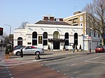
South Hampstead railway station is on Loudoun Road in the London Borough of Camden. It is about 550 yards (500 m) south west of Swiss Cottage Underground station.The Chiltern Main Line crosses over the east end of the station on a bridge, briefly in open air between tunnelled sections on each side of the cutting.

Excerpt from the Wikipedia article South Hampstead railway station (License: CC BY-SA 3.0, Authors, Images).

South Hampstead railway station
Langtry Walk, London South Hampstead (London Borough of Camden)

Geographical coordinates (GPS) Address Nearby Places
placeShow on map

Wikipedia: South Hampstead railway stationContinue reading on Wikipedia

Geographical coordinates (GPS)

Latitude Longitude
N 51.5408 ° E -0.1802 °
placeShow on map

Address

Langtry Walk
NW8 0DQ London, South Hampstead (London Borough of Camden)
England, United Kingdom
mapOpen on Google Maps

South Hampstead Station geograph.org.uk 879711
Share experience

Nearby Places

Marlborough Road tube station

Marlborough Road (sometimes shortened to Marlboro Road) is a disused London Underground station in St John's Wood, north-west London. It opened in April 1868 on the Metropolitan & St. John's Wood Railway, the first northward extension from Baker Street of the Metropolitan Railway (now the Metropolitan line). In the mid-1930s the Metropolitan line was suffering congestion at the south end of its main route, where trains from its many branches shared the limited capacity between Finchley Road and Baker Street. To ease this congestion, new deep-level tunnels were constructed between Finchley Road and the Bakerloo line tunnels at Baker Street; then, commencing on 20 November 1939, the Metropolitan's services toward Stanmore were transferred to the Bakerloo line (they are now on the Jubilee line) and ran to Baker Street through the new tunnels. Upon the transfer, Marlborough Road station was closed and replaced by St John's Wood station, then on the Bakerloo line; it had been little used, except (owing to its close proximity to Lord's Cricket Ground) during the cricket season.Shots of the remains of the platforms, and an outside shot of the station building and booking hall—which at the time was in use as a steak restaurant—were included in Metro-Land, a 1973 documentary presented by John Betjeman. The building housed a Chinese restaurant until 2009 and now contains a substation installed as part of the power upgrade programme to support the introduction of S stock on the Metropolitan line.Marlborough Road itself was renamed Marlborough Place in the 1950s.