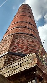
River Hamble Country Park
Country parks in HampshireFarm museums in EnglandLiving museums in EnglandLocal Nature Reserves in HampshireMuseums in Hampshire ... and 1 more
Use British English from February 2023

River Hamble Country Park is a 144.1-hectare (356-acre) Local Nature Reserve which runs along the west bank of the River Hamble between the villages of Botley and Bursledon in Hampshire. It is owned by Hampshire County Council and managed by Hampshire Countryside Service. It is part of Solent and Southampton Water Ramsar site and Special Protection Area, and of Solent Maritime Special Area of Conservation. Part of it is in Upper Hamble Estuary and Woods, which is a Site of Special Scientific Interest.
Excerpt from the Wikipedia article River Hamble Country Park (License: CC BY-SA 3.0, Authors, Images).River Hamble Country Park
Tanhouse Lane, Southampton Wildern
Geographical coordinates (GPS) Address Nearby Places Show on map
Geographical coordinates (GPS)
| Latitude | Longitude |
|---|---|
| N 50.899 ° | E -1.289 ° |
Address
Tanhouse Lane
SO30 2SZ Southampton, Wildern
England, United Kingdom
Open on Google Maps


