Turkey Street railway station
DfT Category E stationsEnfield, LondonFormer Great Eastern Railway stationsLondon stations without latest usage statistics 1415London stations without latest usage statistics 1516 ... and 8 more
Rail transport stations in London fare zone 6Railway stations in Great Britain closed in 1919Railway stations in Great Britain opened in 1891Railway stations in Great Britain opened in 1960Railway stations in the London Borough of EnfieldRailway stations served by London OvergroundReopened railway stations in Great BritainUse British English from August 2012

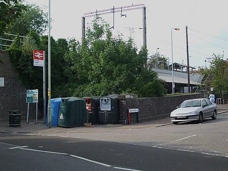
Turkey Street is a London Overground station on the Southbury Loop section of the Lea Valley lines, located in the Bullsmoor area to the north of Enfield in north London. It is 12 miles 16 chains (19.6 km) down the line from London Liverpool Street and is situated between Southbury and Theobalds Grove.
Excerpt from the Wikipedia article Turkey Street railway station (License: CC BY-SA 3.0, Authors, Images).Turkey Street railway station
Teal Close, London
Geographical coordinates (GPS) Address External links Nearby Places Show on map
Geographical coordinates (GPS)
| Latitude | Longitude |
|---|---|
| N 51.6726 ° | E -0.0472 ° |
Address
Turkey Street
Teal Close
EN3 5TL London (London Borough of Enfield)
England, United Kingdom
Open on Google Maps


