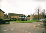
Newbottle, Northamptonshire
Newbottle is a civil parish and largely deserted village in West Northamptonshire, about 4 miles (6.4 km) west of the market town of Brackley. It is close to the Oxfordshire county boundary and about 4.5 miles (7.2 km) south-east of the town of Banbury. The village's name means 'new building'.A stream that is a tributary of the River Cherwell forms the parish boundary to the north-west. The remainder of the parish boundary mostly follows field boundaries. The parish includes the larger village of Charlton, about 0.5 miles (800 m) south-east of Newbottle. The 2001 census recorded a parish population of 438, most of whom live in Charlton. increasing to a joint population of 528 at the 2011 census,
Excerpt from the Wikipedia article Newbottle, Northamptonshire (License: CC BY-SA 3.0, Authors).Newbottle, Northamptonshire
Geographical coordinates (GPS) Address Nearby Places Show on map
Geographical coordinates (GPS)
| Latitude | Longitude |
|---|---|
| N 52.028 ° | E -1.239 ° |
Address
OX17 3DD
England, United Kingdom
Open on Google Maps


