place

Drakelands Mine

Tin mines in DevonTungsten mines in EnglandUse British English from September 2017
Hemerdon Mine1
Hemerdon Mine1

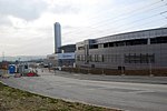
Drakelands Mine, also known as Hemerdon Mine or Hemerdon Ball Mine, is a tungsten and tin mine. It is located 11 km (7 miles) northeast of Plymouth, near Plympton, in Devon, England. It lies to the north of the villages of Sparkwell and Hemerdon, and adjacent to the large china clay pits near Lee Moor. The mine had been out of operation since 1944, except for the brief operation of a trial mine in the 1980s. Work started to re-open it in 2014, but it ceased activities in 2018. It hosts the fourth largest tin-tungsten deposit in the world.A new company, Tungsten West plc, now plan to re-open the mine in 2022, after investing to alter the processing plant. A ground up review lead to the recognition that the ore is not in fact Wolframite, but is in fact a related ore, Ferberite, and changes were needed to improve extraction efficiencies. In addition, a subsidiary will enhance the mine with aggregate sales as a by-product of mining.

Excerpt from the Wikipedia article Drakelands Mine (License: CC BY-SA 3.0, Authors, Images).

Drakelands Mine
Ledgate Lane, South Hams

Geographical coordinates (GPS) Address Nearby Places
placeShow on map

Wikipedia: Drakelands MineContinue reading on Wikipedia

Geographical coordinates (GPS)

Latitude Longitude
N 50.41 ° E -4.01 °
placeShow on map

Address

Ledgate Lane
PL7 5FB South Hams
England, United Kingdom
mapOpen on Google Maps

Hemerdon Mine1
Hemerdon Mine1
Share experience

Nearby Places

Langage Power Station

Langage Power Station is a combined-cycle power plant near the city of Plymouth in Devon, England. Centrica, the original owners of the site, announced on 16 June 2006 that the natural gas fired power station was to be constructed on their behalf by Alstom. Section 36 consent was granted in 2000 and Reserved Matters were approved in 2005. The 885 MW plant was expected to cost £400 million and to start generating in early 2009, but problems with internal pipework pushed this back. The power station was completed and operations started in March 2010. Langage was set to be the first fossil fuel power station built in the UK since 2005, but due to delays it was preceded by Marchwood Power Station, which was commissioned in 2009. Multiple other CCGT stations were also commissioned around this time, including Pembroke Power Station and West Burton B. The station was commissioned against an expected 'energy gap' in UK generating capacity, caused by the expected closure of nuclear and older coal-fired stations.The power station had permission to build three gas-powered turbines when it bought the site in 2004, but due to land constraints they were only able to build two.The plant uses two Alstom GT26 gas turbines, each driving an air-cooled turbogenerator, with a heat recovery steam generator powering a single STF30C steam turbine which also drives another air-cooled turbogenerator.Centrica put the plant up for sale in May 2014, stating an aim to invest in smaller, more flexible power stations. On 21 June 2017, Centrica agreed to sell the power station to EP UK Investments as part of a deal that also saw South Humber Bank CCGT power station change hands between the two companies. EP UK Investments is the daughter company of EP Power Europe, which is 100% owned by Czech energy group EPH (owned by Daniel Křetínský). The UK high pressure national gas pipeline network (the National Transmission System) was extended to Plymouth in 1989 (Feeder No.20 terminates at an Above Ground Installation (AGI) south of Smithaleigh). Langage Power Station was built to exploit the availability of high pressure gas and the station now represents the southernmost gas-fired station on the network.

Boringdon Camp
Boringdon Camp

Boringdon Camp is an English Iron Age and Roman earthwork in Cann Woods, near Plympton, Plymouth, Devon. It is a scheduled ancient monument and owned by South Hams District Council. The site is on a hilltop at 140 metres (460 ft) above sea level, with views down the Plym Valley of Plymouth Sound, 11 kilometres (7 mi) away. The site is located immediately behind the Cann Wood parking at the modern road from Plympton to Shaugh Prior. Since 1st April 2016, the site is closed to visitors, however. The reasons given are the erosion of the earthwork due to visitors walking on it, and conflicts between dogs not kept on lead and grazing sheep (the latter being essential for the conservation of the site).The fort is constructed around an earlier ring ditch, and covers an area of around 2 hectares (4.9 acres). The remains consist of a sub-circular enclosure surrounded by an 8-metre (26 ft) rampart and a similarly sized outer ditch. This ditch can still be seen in places, though tree planting has covered some of the defences around the main entrance. To the east of the fort is a banked path, the remains of a medieval road from Plympton to Shaugh Prior. The road was abandoned in the early 19th century. The site was listed as a scheduled ancient monument in 1939. Quarrying in the area has led to disturbance of the site, and part of the area around Boringdon Camp is now a golf course. A former lead mine and its smelt mill are also nearby. The mining remains are also a scheduled monument, as is a deer park which was established in Boringdon Wood in 1699. Traces of another deer park constructed to the east in the early 18th century have also survived.