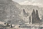
Mynydd Perfedd
Gwynedd geography stubsHewitts of WalesLlanberisLlanddeiniolenLlandygai ... and 3 more
Mountains and hills of GwyneddMountains and hills of SnowdoniaNuttalls

Mynydd Perfedd is a mountain in Snowdonia, Wales, forming part of the Glyderau. The summit has a shelter cairn, offering good views of Foel-goch's north-eastern face, and the Carneddau. Between it and Carnedd y Filiast, there are dramatic cliffs to the east, including the famous Llechen Cytrolar. To the south lies the parent peak Elidir Fawr, to the west Carnedd y Filiast and to the east Foel-goch and Y Garn. It is 812 metres (2,664 ft) high. The average annual temperature of the mountain is about 6 Celsius.
Excerpt from the Wikipedia article Mynydd Perfedd (License: CC BY-SA 3.0, Authors, Images).Mynydd Perfedd
Lon Las Ogwen,
Geographical coordinates (GPS) Address External links Nearby Places Show on map
Geographical coordinates (GPS)
| Latitude | Longitude |
|---|---|
| N 53.136609 ° | E -4.05792 ° |
Address
Mynydd Perfedd
Lon Las Ogwen
LL57 3LJ , Llandygai
Wales, United Kingdom
Open on Google Maps


