Fortis Green

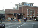
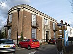
Fortis Green is a ward in the extreme northwestern corner of the Borough of Haringey, north London. It is also the name of the road that runs between Muswell Hill and East Finchley which forms part of the A504. The ward lies between Colney Hatch to the north, Muswell Hill to the east, Highgate to the south and East Finchley to the west. It is a mostly residential area, although it also contained two large hospitals: Coppets Wood Hospital to the north, which was the Infectious and Tropical Diseases Unit of the Royal Free Hospital NHS Trust, and St Lukes Woodside Hospital to the south. Both of these hospitals are now closed. Fortis Green ward has a population of about 12,000 and is generally a middle-class area, with a higher proportion of skilled and highly qualified employees than the borough average (40.7% as compared with 26.3% are in social grade AB). More than half of the 16- to 74-year-olds in Fortis Green are qualified to degree level or higher, and employment levels are very high. About 85% of the population is White, higher than the borough average of about 65%. Of housing stock, 47.2% is in houses and 52.8% is in flats. Fortis Green Road and Muswell Hill Broadway are the main shopping thoroughfares and the parish church is dedicated to St James. The nearest tube stations are at East Finchley and Highgate.
Excerpt from the Wikipedia article Fortis Green (License: CC BY-SA 3.0, Authors, Images).Fortis Green
Fortis Green, London Muswell Hill (London Borough of Barnet)
Geographical coordinates (GPS) Address Nearby Places Show on map
Geographical coordinates (GPS)
| Latitude | Longitude |
|---|---|
| N 51.59 ° | E -0.162 ° |
Address
Fortis Green 25
N2 9HS London, Muswell Hill (London Borough of Barnet)
England, United Kingdom
Open on Google Maps


